


Tejeda
- Artenara - Cruz de Tejeda (Trail nº10)
- Cruz de Tejeda - El Aserrador (Trail nº11)
- Degollada de La Goleta - La Culata - Cruz de Timagada (Trail nº12)
- Cruz de Timagada - Roque Bentayga (Trail nº13)
- Cruz de Tejeda - La Isa - Tejeda (Trail nº14)
- Degollada de Becerra - La Culata - Tejeda (Ruta nº15)
- Llanos de La Pez - Cruz del Saucillo (Trail nº16)
- Cruz de Tejeda - Tejeda (por Museo de plantas medicinales) (Trail nº17)
- Cruz de Timagada - La Culata - Tejeda (Trail nº18)
 The municipality of Tejeda is located in the east central part of the island, and it has a surface area of 104 square kilometres. The highest point on the island, the Pico de las Nieves, is located here, and it reaches a height of 1,949 metres. Tejeda borders the municipalities of Artenara and Moya to the north, Valleseco and Vega de San Mateo to the northeast, San Bartolomé de Tirajana and Mogán to the south and Aldea de San Nicolás to the west.
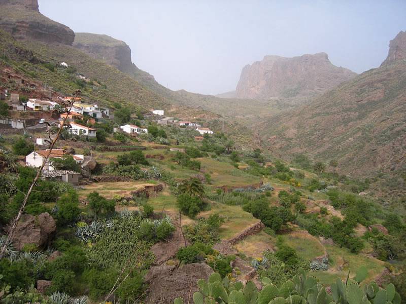
Tejeda can be reached from any point on the island, but the fastest and most comfortable access is from Las Palmas de Gran Canaria, the capital of the island, along the GC-15 road. Over a distance of about 44 Km, the stunningly scenic road runs through the municipalities of Santa Brígida and San Mateo before reaching Tejeda, the very heart of Gran Canaria. The municipality is currently made up of over 20 villages, hamlets and settlements, with the actual old village of Tejeda itself at its centre. Some of the other quarters are Cuevas Caídas, El Carrizal, El Chorrillo, El Espinillo, El Juncal, La Solana o La Tosca.
Weather conditions in Tejeda are subject to wide-ranging variations depending on elevation, relief and orientation with regard to the trade winds. Between the altitude of 1,400 metres and Pico de las Nieves, the highest point on the island at a height of 1,949 metres, the climate is generally humid. Towards the south and the west of the municipality the climate is on the whole subhumid.
 Average annual temperature is about 19ºC, and average rainfall is 700 mm per year.
Obviously, the varying climatic and topographic conditions are reflected in the vegetation as well.
The vegetation in the humid high mountain region consists mostly of Canarian (Pinus canariensis) -and to a lesser extent, Californian (Pinus radiata)- pine forests and other smaller species such as the Canary Islands broom (Teline microphylla), the Teide wallflower (Erysimum scoparium), the Canary Island white sage (Sideritis dasygnaphala) and Canary marguerite (Argyranthemum adauctum ssp canariense). Finally, and as a consequence of former shepherding activity, there are also some grazing meadows.
In the higher areas to the west and the south pine forests continue to predominate, but given the lower rates of rainfall and humidity they tend to be more open. The undergrowth changes as well, with a prevalence of false brooms (Chamaecytisus proliferus ssp meridionalis), flatpods (Adenocarpus foliolosus var villosus), Canary Island rock roses (Cistus symphytifolius var symphytifolius), Montpelier rock roses (Cistus monspeliensis) and bitter spurges (Euphorbia obtusifolia).
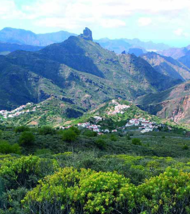
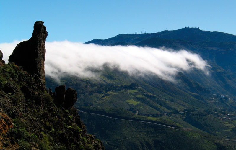
The Caldera of Tejeda is the result of the combination of volcanic activity and the effects of erosion, which have given rise to a spectacular relief, a rugged, abruptly uneven terrain with a variety of memorable outcrops.
The large volcanic plugs known as Roques, such as Bentayga, Nublo, Fraile and la Rana, the many cone sheet dykes that erosion has brought to the surface, the deep gullies and steep mountain sides, all together make up an awe-inspiring scenery. There are also all sorts of volcanic rocks to delight geologists: basalt rocks, syenites, ignimbrites, trachytes and rhyolites, phonolites and so on.
 The extraordinary caldera marks the birthplace of the island, when about 14.5 million years ago an eruption gave rise to a shield cone volcano that was to become the first stage in the fascinating volcanic history of the Gran Canaria.
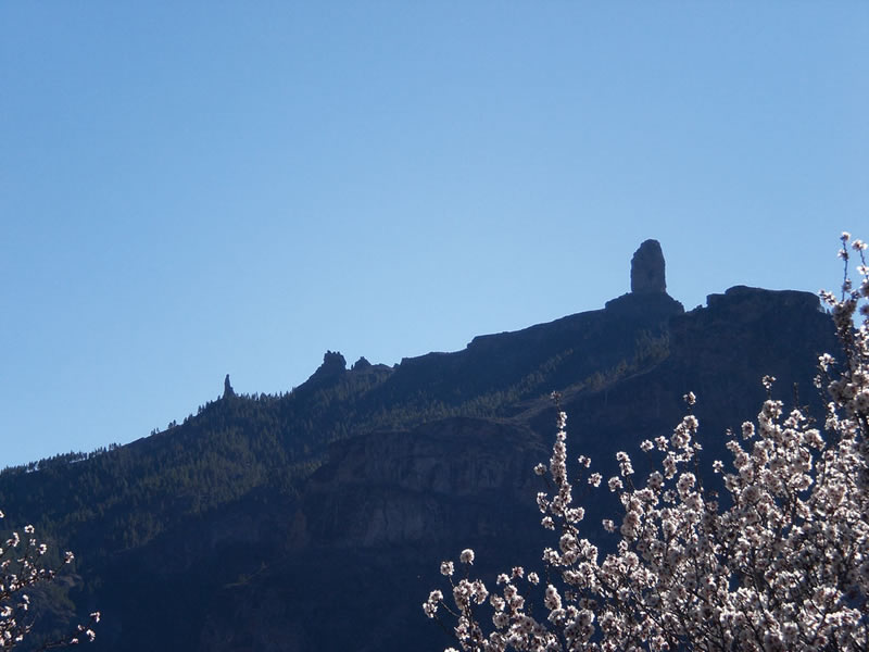
Two rocky outcrops, Roque Nublo and Roque Bentayga, the result of millions of years of erosion, have become geological symbols of the island.
The extraordinary caldera marks the birthplace of the island, when about 14.5 million years ago an eruption gave rise to a shield cone volcano that was to become the first stage in the fascinating volcanic history of the Gran Canaria.
Two rocky outcrops, Roque Nublo and Roque Bentayga, the result of millions of years of erosion, have become geological symbols of the island.
Roque Nublo reaches a height of 1,813 metres above sea level and, escorted by two other volcanic plugs mentioned above, El Fraile and La Rana, has become a symbol that stands for Gran Canaria. Another majestic basaltic neck, Roque Bentayga, was once a place of worship for the prehispanic inhabitants of the island.
Before the conquest of Gran Canaria by the Crown of Castille, the island was governed by several chieftains, each of whom ruled over one of the chiefdoms that the island (known to them as Tamarán) was divided into. This area was under the rule of a chieftain called Texeda, from whom the present name of the municipality derives.
There are several significant archeological sites in Tejeda, which make up an important cultural heritage. At Roque Bentayga we have the Cuevas del Rey (the King's Caves), an almogarén (place of worship) and letter-shaped libyco-berber rupestral engravings. At both Mesa del Junquillo and Montaña del Humo there are cave dwellings and silos and rupestral engravings.At Solana del Pinillo there are several caves that served as homes, silos and burial sites. At Risco Chimirique there is a site where the remains of a prehispanic home have been dug up.
 Many of these troglodyte dwellings were permanent abodes, but others had a seasonal use associated with shepherding and cattle grazing, which were important activities for prehispanic Canarians, who would herd their cattle to mountain pastures during the summers.
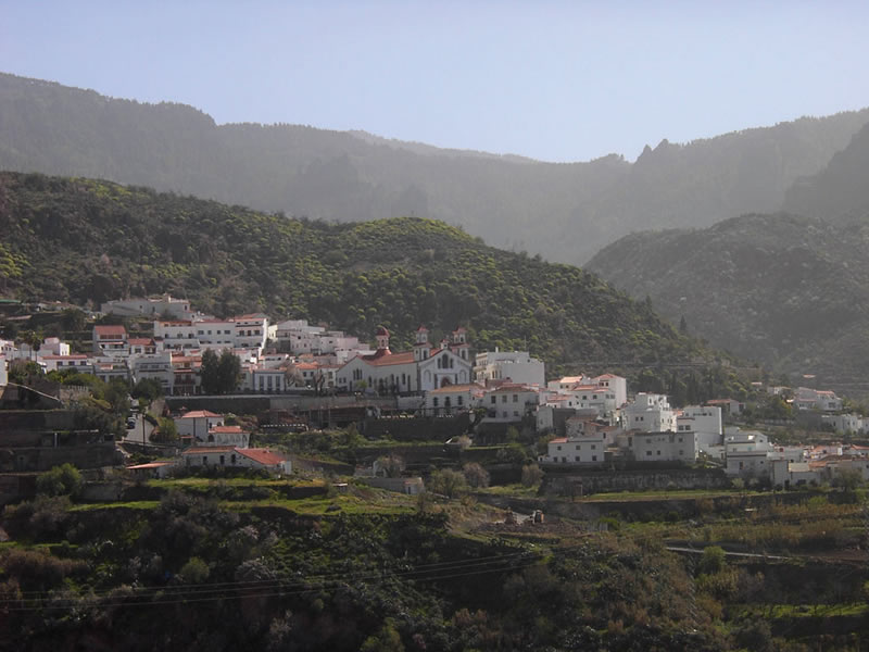
The actual village of Tejeda is located at the bottom of this large depression, at a height of 1,050 metres above sea level, at the very heart of this stunning volcanic feature that marks the genesis of Gran Canaria, and which has been a source of inspiration for many. Perhaps the best known and most often quoted observation on it was the writer and philosopher Miguel de Unamuno's, who described this scenery as resembling a “petrified storm”.
Due to its remoteness and the scarce means of communication with the island's economic and administrative centres, Tejeda has never had a large population -not until the 18th century did it go over the figure of 1,000 inhabitants. However, improvements in road infrastructures and the preservation of this idylic area has turned this municipality into a prime destination for those who value quality of life above all things.
During the 16th and 17th centuries Tejeda's economy was based on farming -wheat, barley and rye-, cattle raising -mostly sheep and goats- and forest exploitation -mostly pine forests-, whose wood was used for house and ship building and from which coal, torch and resins -tar or pitch. With the introduction of banana plantations pine needles were also made use of for fruit packaging. The following centuries saw few changes, save for a more widespread -and illegal- ploughing of the land caused by a growing population.
Farming, cattle raising, the hotel trade and manufacturing industries -in this order- have become the main sources of employment in modern day Tejeda.
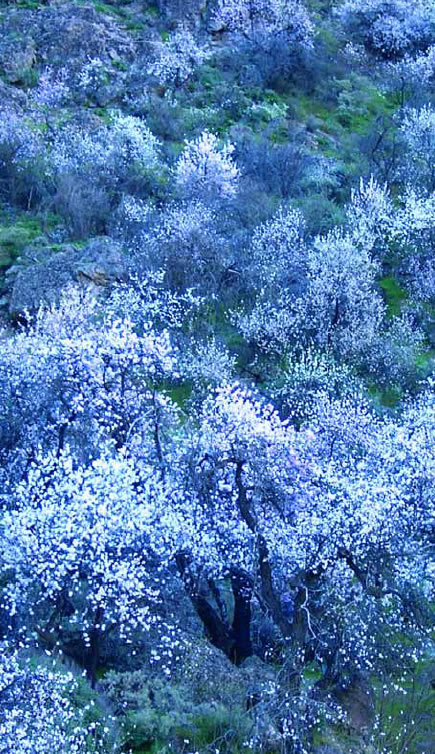
Up until a few years ago, dry farming tended to prevail (especially cereals and fruit), but nowadays irrigation farming is equally widespread, and the most common crops are currently potatoes, vegetables, legumes, forage, cereals and fruit. Almond trees especially have become a distinct feature of Tejeda's landscapes.
Although farming is still a most important economic activity in the municipality, ovine and caprine cattle raising and artisan industries, especially almond-based pastry making, are also traditional sources of income that are still widespread. However, it is the service sector that is currently leading the development of the municipality of Tejeda, embracing the potential offered by a natural environment of high ecological, scenic and cultural value, which, furthermore, was on 29th June 2005 declared a World Biosphere Reserve by Unesco.
98% of the territory of Tejeda is protected under the Law of Protection of Natural Spaces of the Canary Islands. The following protected areas are to be found in Tejeda, either totally or in part: the Integral Nature Reserve of Inagua, the Special Nature Reserve of Los Marteles, the Nublo Rural Park, the Natural Monument of the Riscos de Tirajana, the Natural Monument of the Roque Nublo and the Cumbres (High Mountain Region) Protected Area. The flora and fauna in all these ecosystems and environments is of extraordinary interest, and it includes exclusive endemisms such as the blue chaffinch (Fringilla teydea polatzeki), limited to Inagua, or the Globularia sarcophylla, a rupicolous species that only grows in some of Tejeda's cliffs.
Additionally, Tejeda offers its visitors an excellent well-structured network of trails, some of which are described in this guide book. Of interest are also its traditional festivals, such as those held in February -the Almond Tree in Bloom Festival- or the one held in September to honour the Virgen del Socorro (the Blessed Virgin of Succour). There are some interesting museums and interpretation centres, among them the Abraham Cárdenes Museum of Sculpture, The Tejeda Museum of Traditions, the Medicinal Plants Centre, the Museum of the Three Crosses or the Bentayga Archeological Site Interpretation Centre. The church of Nuestra Señora del Socorro (Our Lady of Succour), at the heart of the village of Tejeda, is an eclectic well-preserved building that is a good example of traditional Canarian architecture. The use of stone, wood and roof tiles reflects mudéjar and Portuguese influences. Inside the church there is a remarkable wood carving of Jesus Christ (Cristo de la Sangre) that has been there since the mid 17th century. All this and much more can be enjoyed wandering at leisure along the streets and trails of the municipality of Tejeda.