


Degollada de La Goleta - La Culata - Cruz de Timagada
GENERAL DESCRIPTION. The Caldera is the birthplace of Gran Canaria. About 14.5 million years ago an enormous volcanic edifice emerged from the depths of the Atlantic which in record time -in geological terms, that is- grew to a height of about 3000 metres above sea level.
After a 500,000 year-long lull a second volcanic mouth developed in the neighbourhood of where the majestic Roque Bentayga rises today, and following a succession of explosive eruptions and brief intervals of calm the island went on growing. This period lasted about 5 million years and was characterized by a succession of extremely explosive eruptions. During an initial stage and due to the speed with which the material found in the magma chamber was expelled onto the surface, the chamber emptied out and the interior of the edifice became hollow and ceased to support the volcano, which subsequently colapsed and sunk back into the empty chamber forming a giant caldera.
 This giant crater would fill again with magma that surged through a dense network of cone sheets and dikes, spilling over and spreading throughout the island, even reaching the sea. Over seven million years, a succession of vast volcanic episodes alternated with brief quieter interludes. Some of the eruptions were extremely violent, like those during which up to 30 metre thick mantle-like deposits of ash were generated. Then, an approximately four-million-year long period of calm followed during which erosive agents modelled the island's relief and the caldera was once again hollowed out.
The last volcanic event in this area took place about 4.5 million years ago and went on for about a million years, giving rise to another great volcanic edifice, the Roque Nublo stratovolcano. Initially quiet emissions gradually evolved into more explosive ones as magma came into contact with large reservoirs of underground water. It all eventually ended with a vast explosion and the collapse of the southwest flank.
As we have already mentioned, this landscape was described as a “petrified storm” by the well-known and controversial writer, playwright, poet and thinker Miguel de Unamuno, perhaps one of the most ingenious and fitting descriptions written of this spectacular space.
 Nowadays a walk around the interior of the Caldera allows us to view the diverse geological material generated by the different eruptive stages described above: basalts, trachytes, syenites or phonolites, as well as the lavas and breccias of the great Roque Nublo edifice. The path that leads up to La Culata traverses the very crater of the old Roque Nublo volcanic edifice, an area characterized by very steep slopes.
At La Culata manmade features are more widespread. Old dwellings are always located at sites that free as much of the scarce farm land as possible, which is skillfully arranged in terraces to maximize production. The crops, mostly potatoes, but also some vegetables and fruit, make for a colourful scenery.
The image below shows a fallow terrace ready to be fertilized by crushing canes into the soil with a tractor. It also shows what is known as papas de la risa (funny potatoes), which are those that sprout after the harvest. La Culata's water supply comes from the Heredad de Los Manantiales (an Heredad might be defined as an association of water owners), whereas irrigation water comes from springs and streams found in the surroundings.

Trail Map
(Click on the map to enlarge it)
Trail Profile
(Click on the map to enlarge it)
 Trail description
Stage 1: Degollada de La Goleta - La Culata
 From Degollada de La Goleta, to the right of the start of the trail that leads up to Roque Nublo, there is a clearly signposted path, cobbled over the first 20 metres, that runs down to La Culata.
The path twists and turns downhill, running across an open pine forest, leaving the Barranquillo del Agua to the right. The path's surface is fine, at stretches there are steps that ease the climb, but it can also be slippery, especially when it has been raining or in winter. Having walked down for a few metres and after a short flat stretch, the trail goes down again, runs across a stream bed and climbs up the opposite slope, where we may observe the presence of willows. We walk among large rocks and pine trees, as well as among other rupicolous species such as berodes, giant sow thistles or cerrajas or aeoniums, plants associated with more humid conditions. In some of the rocks we might be able to observe the tafoni (small cave-like features with rounded entrances) caused by wind erosion.
There are several cobbled stretches flanked by rocks of varying size, the result of old rock falls and slides. The geological material this natural space is made up of is Roque Nublo breccia. As we walk on along the trail the pine forest gradually becomes more and more open, and we start to observe the presence of other species such as false brooms, buglosses, spurges and sages. To the sides of the path we will also find small drystone walls that will help us along in the right direction.
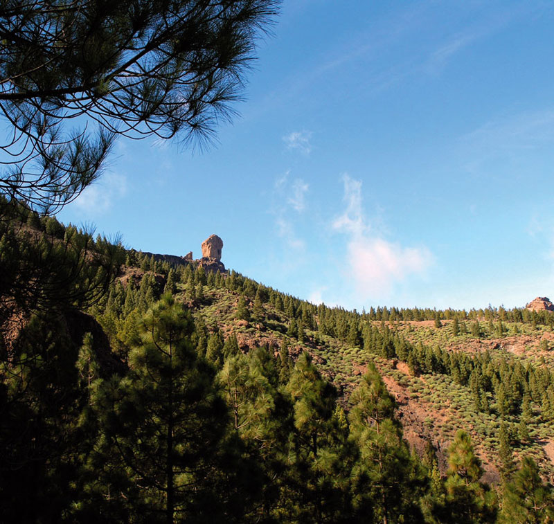
After about a hundred and fifty metres the pine forest comes to an end and it is replaced by shrubland. If we look downhill we'll see La Culata; opposite us there is the large rock known as El Piquillo, and to the left of it, an old cave-dwelling, the Cortijo del Pino, a former grazing ground. This stretch of trail is cobbled and in a good state.
We walk past a crossroads that leads to three different destinations: La Culata, La Goleta and Roque Nublo, and after a further ten minutes we'll come across a concrete track; we walk down it as far as La Hortiguilla, a group of houses in the outskirts of La Culata.
We continue along this track until we eventually reach a tarmacked road. Next to a cluster of houses with gable roofs there is a path running towards the north -its surface is first made of concrete, then cobbled- which is a shortcut we should take unless it is or has been raining, in which case we should continue our walk along the road. We walk under a large fig tree and continue across a small ravine and we arrive back at the tarmacked road we had left earlier on. Here we turn left and walk down towards the centre of La Culata, where we'll find the church, bus stop, bars, social club, etc.
Stage 2: La Culata - Cruz de Timagada
 The second stage of our walk starts right next to the social club, roughly opposite the bus stop. We take a cobbled path to our left -as we stand in front of the club-, and walk downhill and across a small ravine. We then walk uphill as far as a dirt track, where we turn left. After about 20 metres we turn right and walk past a house; we again walk across a small ravine where we'll find a spring and a water trough and some Canary Island willows.
We continue walking uphill on a cobbled path towards the north west. When we get to a tight curve to the right, if we look back, we will be able to enjoy the view of the private grazing grounds of La Mesa, with La Culata in the background.
We go on along a well-cobbled path, flat stretches alternating with uphill slopes, amidst brooms, false brooms and almond trees, and we will eventually get to a fork; the turning to the right runs down in the direction of the village of Tejeda, but we continue straight ahead, towards Cruz de Timagada.
Potatoes (Solanum tuberosum)
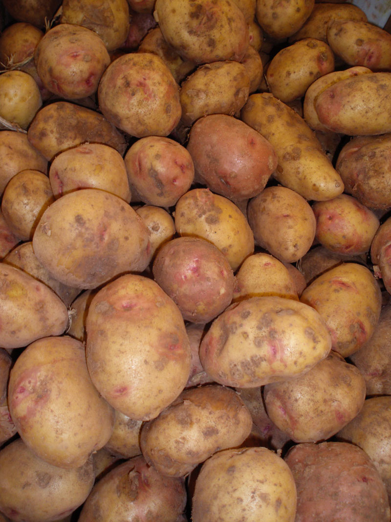
The potato is a tuberous crop from a herbaceous perennial plant that grows up to a height of 60 cm. The plant bears white, pink, red, blue or purple flowers with yellow stamens. The edible tubers of varieties with white flowers usually have white skins, whereas those of varieties with coloured flowers generally have pinkish skins.
The potato is one of the most widely consumed products on the island, and a fundamental component of Canarian cuisine, mainly as an accompaniment to many dishes. “Wrinkled potatoes” are perhaps the best known Canarian potato dish internationally.
The plant comes originally from the Andes region in South America, from where it was exported to Europe.
Almost from the moment it first arrived in the islands -mid-16th century- it became, together with gofio, an important part of the basic diet of rural population. It quickly became acclimatised, adpating easily to both soil and climate. It is grown practically everywhere in the islands, and there are several varieties. Farmers would formerly store them in caves or in sheds near the fields, covering them with ferns to prevent them from sprouting or rotting.
The varieties grown are usually -though not always- known by their colour: the best known are the papa bonita (“pretty potato”), the red, white, black potatoes and the papa nueva (new potato). Papa bonita and papa nueva are perhaps the tastiest and most popular.
El Roque Nublo
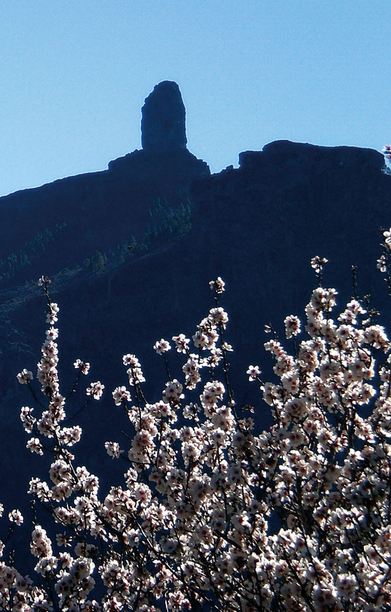
This 80-metre tall volcanic plug at 1,813 metres above sea level has become a symbol for the island of Gran Canaria. It was declared a Natural Monument by the Law on Protected Natural Spaces in the Canary Islands. The protected area covers a surface of 451.8 hectares and it is found within the municipality of Tejeda, practically in the geographical centre of the island.
The area is characterized by a geological material known as “Roque Nublo breccia”, the result of the sunken stratovolcano's emissions. There was an initial eruptive phase with emissions of lava flows followed by more explosive phases that culminated in a very violent final eruption that brought about the sinking of a great part of the volcanic edifice. After that it was erosive agents that gradually sculpted the area's present relief.
This basaltic conglomerate plug also draws climbers eager to reach its summit up one of the 24 existing routes. A team of German climbers were apparently the first ones to reach the top.