


Villa de Santa Brígida
- La Bodeguilla - La Atalaya (Trail nº28)
- Puente de Las Meleguinas - Maipez (Trail nº29)
- Valsequillo - Villa de Santa Brígida (Trail nº30)
- Villa de Santa Brígida - Teror (Trail nº31)
- Utiaca - Barranco Alonso (Trail nº32)
- El Tejar (Trail nº33)
- Caldera de Bandama (Trail nº34)
- Casco Histórico (Trail nº35)
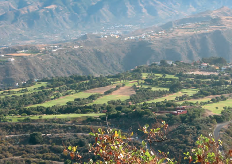
 The municipality of Villa de Santa Brígida is on the northeastern side of the lower Middle Mountain Region of Gran Canaria, at an altitude between 350 and 940 metres above sea level. It borders the municipality of Las Palmas de Gran Canaria to the north, at Llanos de María Rivera, and to the east, along the Caldera of Bandama. It borders Teror to the northwest, at Lomo de la Vizcaína, and San Mateo to the west, at El Madroñal. And finally, it borders Valsequillo and Telde to the south, along the Barranco de las Goteras ravine. It has a roughly rectangular surface area of 23.8 square kilometres -1.53% of the island's surface area. It is 14 kilometres away from the city of Las Palmas de Gran Canaria.
It is the most populated municipality among those that make up the Association of Middle Mountain Region Municipalities of Gran Canaria. Its notable demographic growth is due to the suburban residential role it has come to play over the last few years.
The island's volcanic character is particularly noticeable in the municipality of Villa de Santa Brígida, where we can see old material brought to the surface by erosion, Roque Nublo type agglomerates and Post-Roque Nublo eruptive edifices -among the latter, the most significant are the Montaña de La Bodeguilla and la Caldereta del Lentiscal volcanoes, and the Pino Santo and Bandama calderas.
 The landscape in the municipality is characterized by polylobulated basins, abrupt hillsides and the predominance of middling slopes where farming flourishes.
There is an annual rainfall rate of between 374mm and 500mm, and a high relative humidity throughout the year caused by the constant presence of a sea of clouds generated by trade winds. Temperatures fluctuate between a minimum of 6ºC and a maximum of 29ºC. Winds blow weakly throughout most of the year, although during the winter months they tend to intensify. Thermal invasions from the Sahara are not frequent. The Mediterranean type climate, with summers tempered by breezes from the Atlantic, favoured an early and important tourist development in the area of Monte Lentiscal - Villa de Santa Brígida.
The vegetation is made up mostly of relics from thermophilic forests, mainly thickets and copses of wild olive and mastic trees and lentiscs -the latter adapting particularly well to xeric conditions on sunny hillsides. There are also splendid specimens of dragon trees, the one found on an escarpment on the Barranco Alonso ravine being a case in point. On hillsides there are berodes, buglosses, and giant sow thistles, and along ravine beds palm trees and -to a lesser extent- mastic trees.
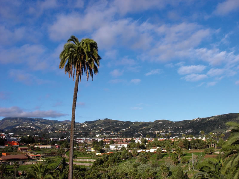
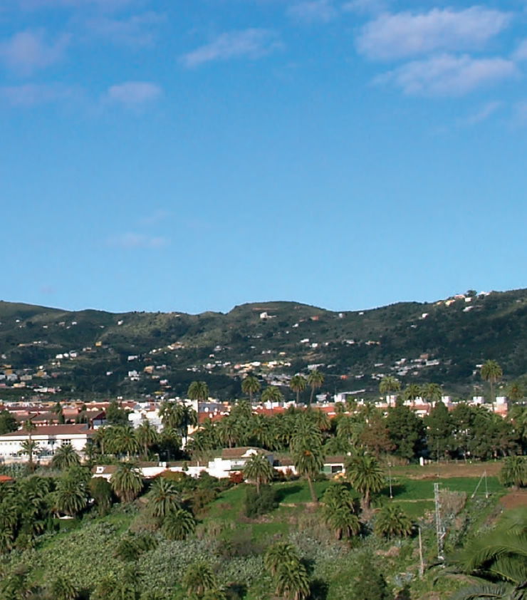
 Palm trees stand out among the vegetation that characterizes the landscape throughout the municipality. The second lushest surviving palm tree forest on the island grows in Villa de Santa Brígida. The villagers' demonym, satauteño, derives from the prehispanic term satautey, used to refer to both the trees and those who lived near palm tree forrests. It is a very useful tree for artisans: its leaves are used to make plaited strands, fabrics, hats, rugs, bags and mats, among other things; its leaf stalk (known in the Canaries as pírgano), is used to make broom sticks.
The municipality has several areas under different degrees of protection. The Protected Landscape of Tafira forms part of several municipalities, and about 35% of its surface area lies in the municipality of Santa Brígida. Likewise, 20% of the surface area of the Protected Landscape of Pino Santo lies in the municipality of Santa Brígida. The Caldera of Bandama, which together with the Peak of Bandama forms a complex that has been declared a Natural Monument) makes up 15.8% of the total surface area of the municipality of Santa Brígida. The palm tree grove of Satautejo, the Barranco de Las Goteras ravine and the Altos de la Concepción area are also protected spaces.
Among non-native crops, sugar cane was grown during the 16th century, and was mostly used for the manufacturing of rum and sugar loaves at sugar mills. During the 17th century vineyards were planted, which gave rise to the characteristic landscape that is still to be seen in the areas of Bandama and Monte del Lentiscal. The wine produced in these areas enjoys a good reputation, both in and outside the island. In the 18th century potatoes and prickly pear or cochineal nopal cacti were brought over from their native America, the latter for the production of cochineal, which was in great demand in European markets for the manufacturing of dyes. During the 19th and 20th centuries fruit and ornamental plants were widely grown, both for the home market and for export.
The history of Villa de Santa Brígida goes back to the 15th century, when a small settlement was founded at El Espolón, near the Barranco Guiniguada ravine, where there was a spectacular palm tree forest of which some fine specimens are still to be seen. The fertile soils and abundance of water favoured the development of farming, and the area became an important supplier of agricultural produce to the city of Las Palmas de Gran Canaria. /p>
Thanks to the visits by Leopoldo Buch (1836) and Olivia Stone (1887), and to their descriptions, the appeal of the municipality became widespread. They described the Caldera of Bandama as one of the most important volcanoes in the world, on account of its depth and appearance. They wrote admiringly of La Atalaya, of its cave-dwellings, inhabitants and pottery. Olivia Stone's work, the very first tourist guide of the Canary Islands, the landscape of La Atalaya and Bandama are extensively described. As a result of this a number of hotels opened locally, among them Hotel Santa Brígida, Hotel Quiney or Bella Vista Hotel. 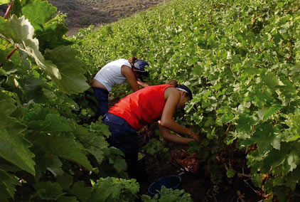 Throughout the 20th century, visitors have come to the municipality drawn by the handmade pottery of the women in La Atalaya, by the spectacular Caldera or the scenic beauty of the area, as well as by local customs, festivities and markets.
The main villages and hamlets to be found in the municipality of Villa de Santa Brígida are the following: El Gamonal, La Angostura, La Atalaya, El Madroñal, Monte Lentiscal, Pino Santo Alto, Pino Santo Bajo, Lomo Espino, Las Meleguinas, San José de las Vegas, Las Goteras (shared with the municipality ofTelde) y Llanos de María Ribera (shared with the municipality of Las Palmas de Gran Canaria).
The main festivities are: the festivity of the Rosary, on the first Saturday in August, when the victory of Canarian troops over Admiral Van der Doez is celebrated. In July, the pottery-related Traída del Barro ("The fetching of clay") takes place in La Atalaya -a favourite of fun lovers and revellers. In June Saint Anthony of Padua's day, Nuestra Señora de la Salud (Our Lady of Health) in Pino Santo Alto in August, the Bajada al Velero, in August, when the villagers go down to the washing place in Las Meleguinas, Los Finaos (The deceased) in November, The Sacred Heart of Jesus in El Gamonal in June, Our Lady of Fátima in Pino Santo Bajo in May, Nuestra Señora del Carmen (Our Lady of Mount Carmel) in Las Meleguinas and La Angostura in July, The Festivity of Christ in La Atalaya in September and the festivity of Virgen del Pilar (Our Lady of the Pillar) in El Madroñal in October.
 Villa de Santa Brígida has a rich artistic heritage, notably the Church of Santa Brígida (Saint Bridget's Church), built in 1522 on the same site as the original chapel, which had been destroyed in a fire. The present building is neogothic in style.
Canarian cuisine is well represented in Villa de Santa Brígida: grilled meat, vegetable potages and exquisite broths are widely served in traditional restaurants and wineries. Visitors should try glossy sponge cakes, Mano de Hierro sausages, local gofio and Monte Lentiscal wines (which have their own wine route), among the typical food products of Santa Brígida.
Santa Brígida is a quiet municipality, not too far from Las Palmas de Gran Canaria, and well-communicated, which has led to many taking up residence here, hoping to improve their quality of life.