


El Tejar
GENERAL DESCRIPTION. This is a very short itinerary, about two kilometres long. It is an interesting walk in terms of environmental education given its natural, archeological and scenic features.
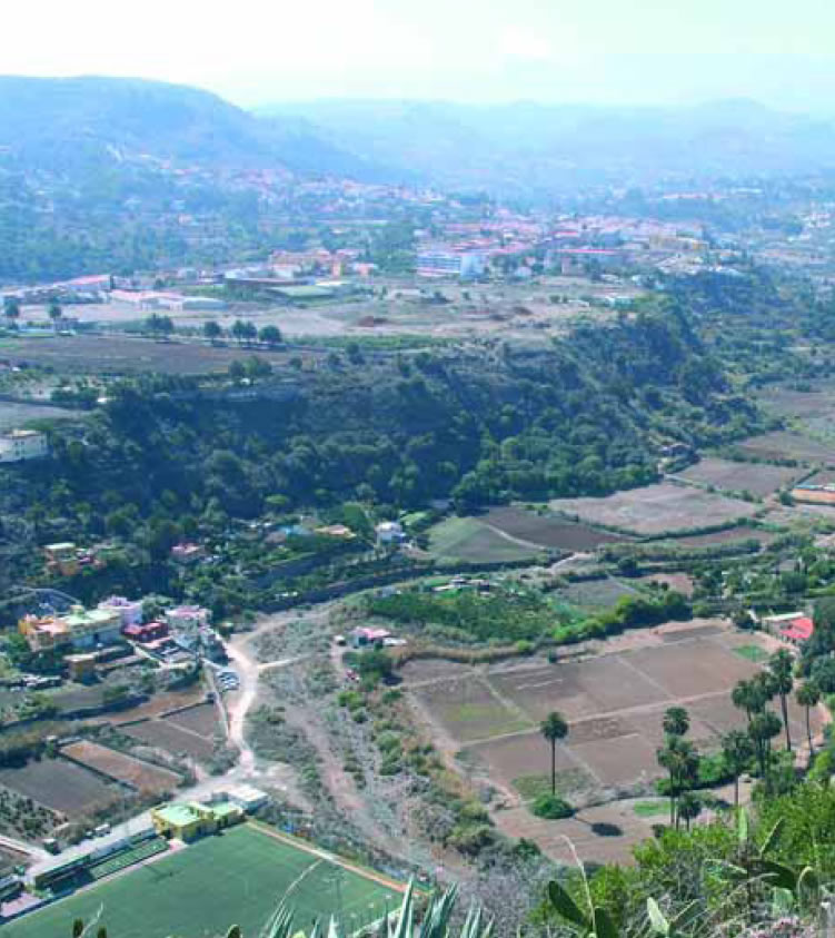
The whole of the itinerary takes place within the municipality of Villa de Santa Brígida, along the edge of one of the escarpments of the great basin of the Guiniguada ravine.
The landscape is essentially agrarian in character. Throughout the itinerary we'll see countless farming terraces where mostly potatoes and vegetables are still grown. Farm fields vary in size, and they occupy both the bottom of the vally as well as the hillsides. Houses tend to cluster in areas that are of lesser use for farming.
There are many wells in the village of La Angostura, though some are no longer in use. At the time of the Spanish conquest the Guiniguada was described as a river with a large flow, and Torriani, an Italian engineer sent by Philip II to analyse and improve the islands' fortifications, wrote about it in his "Descripción e historia del reino de las Islas Canarias" (1588) (Description and history of the Kingdom of the Canary Islands) "...there were palm tree forests and abundant waters...".
 The potential vegetation in this environment is thermophilic, although the watercourse was always populated by palm trees. On the hillsides, potential vegetation would include thickets of wild olive trees, lentiscs and mastic trees. At present, and after centuries of human intervention, there has been a radical change in this valley's vegetation, although our trail runs through some areas where there is an obvious recovery under way, with small thickets of wild olive trees and lentiscs. Pine forests like the one we'll see at the beginning of our itinerary are the result of reforestation programmes undertaken during the 1950s.
We'll see some examples of traditional Canarian architecture along the trail, as well as some archeological sites, like El Tejar. There are many other sites with vestiges of prehispanic life in this area, such as the La Angostura cave complex, Cueva de Los Frailes, El Maipez, Los Silos or Las Huesas. The site at El Tejar was discovered in 1987, when a farming terrace was being cleared. A large amount of archeological material was recovered including pintaderas or seals and the remains of two anthropomorphic idols.

Trail Map
(Click on the map to enlarge it)
Trail Profile
(Click on the map to enlarge ir)
 Trail description
 Our trail starts at El Tejar, in the village of La Angostura. Once we get to La Angostura we should park on its main road and then look for a street that runs up to the La Angostura state school, which is signposted. We walk up a concrete track but just before the first curve to the left, by a house with a metal gate, we'll find a path that we should take. We should, however, walk on first a further fifty metres along this concrete track, for this will bring us to the archeological site of El Tejar, which is worth a visit.
We return to the path that sets off by the curve and continue on our trail. We walk past a house with an orchard to our right, and on the left-hand side the path is lined by a very beautiful drystone wall where some berodes grow weathering the rock.
We carry on along a flat stretch of trail, with the Barranco Guiniguada ravine in the distance, to our right, and we gradually enter a dense grove made up of thermophilic vegetation that includes wild olive trees, lentiscs, palm trees, berodes, buglosses, cornicales (Periploca laevigata) and other non-native but widespread species such as prickly pear cacti.
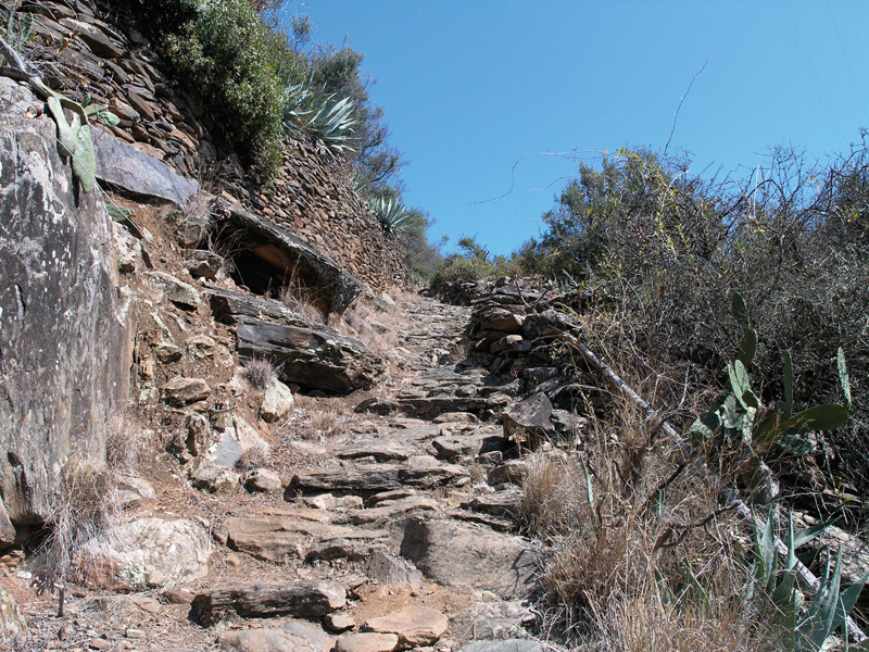
The path resembles now the bed of a ravine, with a stony ground surface, running under a green canopy. We carry on uphill and soon get to a well-cobbled path flanked by equally nice drystone walls. A brief stop will let us enjoy the view of the village of Villa de Santa Brígida to the south. Slightly further up we'll find a pipe which we should follow, ignoring a turning to the right. The views grow more spectacular as we walk up -from Tafira up to the High Mountain region- and the thermophilic vegetation becomes more abundant.
 Once we reach the top we come to a fork: we should take the turning to the right, that leads up to a hill ridge. We walk past a fenced water tank, then through communities of lentiscs and wild olive trees, which have gradually been colonizing this space, until we eventually get to a wooden cross, where we will be able to enjoy wonderful panoramic views of the surrounding area.
If we look out from the edge of the ridge we'll realize that we are in fact perched on top of the abrupt escarpment that encloses the great basin of the Guiniguada to the northwest. The view before us covers a large stretch of the island, from the SW to the NE. Right below us we have the wide bed of the ravine, with extensive farm fields and some small population nuclei. To the southeast we have the Pico de Bandama mountain and to the east another volcano, Caldereta del Lentiscal.
To return, we can take the same path back or we can walk on towards the north as far as an isolated house. From here, the path starts right where the tarmacked road that leads up to the house ends. It is a wide dirt path that runs along a level stretch amidst thermophilic vegetation. After we walk past a metal gate we'll come once again to the fork where we started our ascent to the ridge. From here on we simply follow the same path back to our starting point.
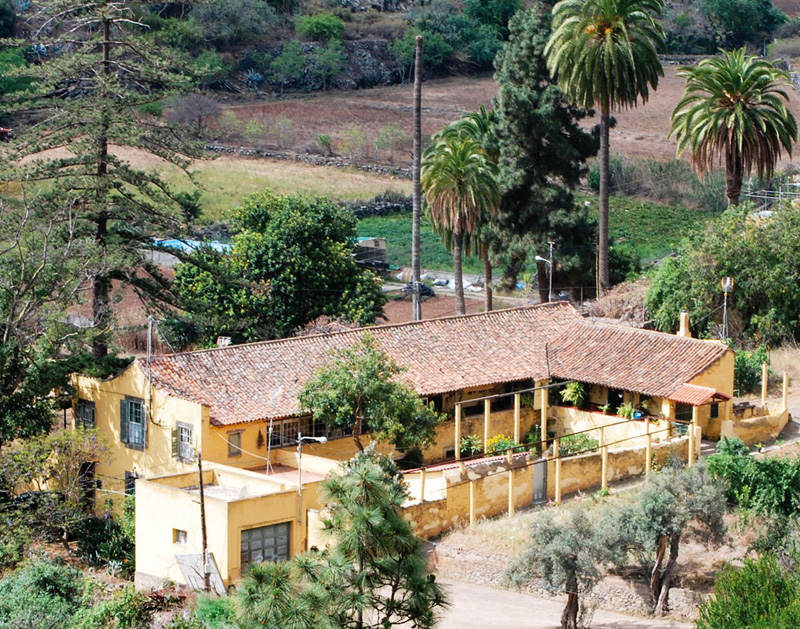
The Massieu house
The municipality of Santa Brígida combines its agricultural past with its current residential character, preserving a varied and rich architectural heritage. The Massieu house is a case in point. It is an old traditional country seat, linked to the farm fields in the neighbouring area of El Tejar. It is painted in ochre and is surrounded by two large araucarias and farm fields. It has two floors and a gable roof; it has a Canarian patio with striking galleries and porches. In its interior there is still some hardwood furniture, some family paintings and an old wood stove.
D. Juan Massieu, mayor of Santa Brígida between 1927 and 1931, was the last member of this family to inhabit the house, which used to be surrounded by fields where potatoes, cabbages, pumpkins and other vegetables were grown. The farm is still cultivated.
(SOURCE: SOCORRO SANTANA, P. (2001): Arquitectura del ayer en HANSEN MACHÕN, A. : Geografía de Sta. Brígida. Ilmo Ayuntamiento de Santa Brígida).
Archeological site of El Tejar

The site is of interest because of its state of preservation and for its potential to expand our knowledge of the aboriginal population. It can be divided in two parts: a complex formed by the structure found in 1987 and the construction attached to it, and a second construction located in the interior of the farming terrace which constitutes the upper side of the archeological site.
This construction is a drystone wall of about two metres in length, and almost certainly of prehispanic origin. The second complex is made up of a completely circular drystone structure to which another construction is attached that very much resembles a habitational structure with side rooms. This possible house dwelling, currently under study, seems to possess a domestic character, given the variability, density and typology of the construction.Its density of occupation suggests a relationship with the use of the other circular structure.
The circular drystone structure has a diameter of about five metres. Its construction is rather irregular and the quality of the building is poor, as there was no apparent attempt to lay stones in regular courses.
To raise this structure the old existing hillside had to be cut, as the wall on its northern side is supported directly on picón or lava gravel or in combination with a filling of rubble. This construction was originally underground, as its walls show, for they would not have stayed up without the support of the cut in the hillside.
Another striking feature of El Tejar is the finding of four large carved stones of about 70 cm in height, two of them in situ, in a vertical position. These stones are known as "betilos" in the local archeological literature(1).
(1) - ∑ Report by Mendoza Medina, F., Moreno Benítez, M. y Súarez Medina, I. for Patrimonio del Cabildo Insular de Gran Canaria.