


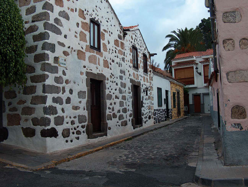
Old Quarter
GENERAL DESCRIPTION. This itinerary explores the centre and outskirts of the village of Villa de Santa Brígida. The settlement, which dates from the 16th century, was first known as "Lugar de La Vega", and it grew initially around the first village church, located on the same site as the present one.
Between the 16th and the 18th century the village developed along two axes: the La Vega road, which connected Villa de Santa Brígida with Las Palmas de Gran Canaria and Vega de San Mateo; and the calle Real (the High Street), that linked the road to La Vega de Arriba (the old name of La Vega de San Mateo) with the church and the road to Teror.
From the end of the 18th century the village started to spread between the main road the Barranco Alonso ravine and the church, giving rise to a compact urban space that did not sprawl onto the surrounding farmland.
From the 19th century on the village expanded across the road to Vega de San Mateo and grew mostly towards the south and east. There were by now about 500 houses in the area, about slightly less than half of them in the village itself. Apart from the streets already mentioned, the village grew along Muro and Calvario streets. It was still a rural settlement, based on mostly on agriculture.
 During the 20th century the village underwent notable changes brought about by the expansion of services linked to new tourist and residential functions. Building took place in all directions, though mainly towards the northeast. Housing typologies changed and sport, educational and cultural infrastructures expanded considerably.

Trail Map
(Click on the map to enlarge)
Trail Profile
(Click on the map to enlarge)
 Trail description
 At the entrance to the village, near the church, in an area known as La Alcantarilla, there is a beautiful building of simple design that is the headquarters of the Heredad de Agua de Satautejo y La Higuera. (An Heredad is an association of water owners) It was built in 1913, on a water distribution basin that supplies water to the different farms in the municipality. The building is crowned by a simple semicircle where there is an old clock that at present simply tells the time, but in the old days served to mark the different irrigation schedules and turns. The clock was ordered from Germany shortly before the outbreak of the First World War (1914), but it only arrived in 1919.
On the left-hand side of the main road, right opposite the Heredad, lies the headquarter of another remarkable institution, the Real Casino de Santa Brígida (The Royal Casino of Santa Brígida. A Casino in Spain was traditionally the equivalent of an English Club). The institution dates from the month of April, 1900, but the building itself was built over the first decades of the 20th century.
Along the same pavement we come across La Fonda (The Inn). As its name suggests, it was originally an inn, and it offered visitors to Santa Brígida, or travellers on their way to the High Mountain Region or elsewhere, both provisions and sleeping accommodation. It is currently renowned for its bizcochos lustrados (glossy sponge cakes), among the best on the island.
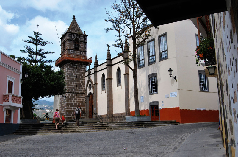
 Our next stop is the parish church of Santa Brígida (Saint Bridget), built over the remains of the first chapel raised in 1522, which was destroyed by a fire. The temple façade is neogothic in style, and its interior reveals the older structure. The church dates from the 20th century, except for the tower, which survived the serious fire that took place in 1897. There are several altarpieces in the chapel, all of them 20th century works. Among the most important carvings we have a Mater Dolorosa and a beautiful baroque-style figure of Saint Anthony of Padua. There is also a spectacular depiction of the Holy Sepulchre, with the body of Christ.
The parish archive is worth mentioning, which is where the records of the first christenings in the village, dating from 1583, are kept, as well as records of the first deaths, marriages, censuses and testaments.
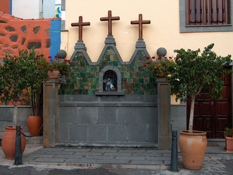
We now walk down Calvario street, which gets its name from a small altar raised at the end of it. It is a striking construction of stone and tile work, with three wooden crosses, inside whose niche there is an image that represents one of the scenes of The Passion of Christ. In past centuries it marked the village's urban limits, and it was the finishing point for the Easter Week procession and the starting point for cortèges. It depicts the Virgin Mary with the body of Christ in her arms on a stand of stonework blocks. A similar altar stands at the village exit in the direction of San Mateo, in this case depicting the Virgen del Carmen (Our Lady of Mount Carmel).
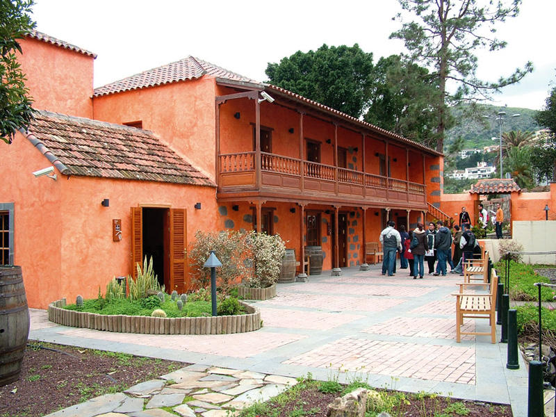 We take the calle Nueva (New street), where the Town Hall lies, towards the park, next to the municipal market, to get to the Casa del Vino (The Wine House). In this restored, over two hundred year old, building we may enjoy PDO "Gran Canaria" wines and learn, in a splendid setting, about the history of vine-growing and wine-making on Gran Canaria. The Museum Room displays a reproduction of an old winery, with casks and other items associated with vine-growing or wine-making. Visitors can become acquainted with the history and traditions of our wines through projections and other digital media.
Once we leave the Wine House, we may choose to visit the Parque Agrícola Guiniguada (Guiniguada Agricultural Park), in the Barranco de Guiniguada ravine, one of the largest on the island. The park lies near the Palmeral de Satautejo (Satautejo Palm Tree forest) and next to the municipal market. The park, known as well as "Finca del Galeón" ("Fruit Warehouse Farm"), includes a livestock farm, sheds, a well and a water tank. The whole area is interconnected by a network of cobbled paths that link small viewpoints, resting spots and constructions. Along the different routes we'll come across fountains, irrigation ditches, water pits and small reused caves. All sorts of traditional crops are grown in the park, among them potatoes, corn, lettuces and so on.
La Fonda and its guests
La Fonda (The Inn) dates from the beginning of the 20th century. It was built in all likelihood between 1918 and 1920. It is located in the old quarter, at 41, Calvo Sotelo street, and as its name indicates, it offered provisions and sleeping accommodation to travellers and visitors. Don Antonio González Jiménez was among its most frequent guests, a remarkable character who earned the friendship and affection of the local population. He arrived in Santa Brígida from Las Palmas de Gran Canaria in 1935 to play football for the local village team, C.D. Santa Brígida. To avoid the tiresomeness of travelling backwards and forwards he rented a room at the Fonda, which he would pay scrupulously -even if often unused. A few years after his death, another illustrious guest happened to stay in the same room over a long period of time, the great poetess Chona Madera, who fell in love with Santa Brígida, and is fondly remembered by all.
Palmeral de Satautejo (Satautejo palm tree forest)
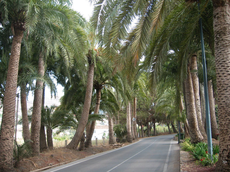
It stretches over about 30 hectares in the municipality of Santa Brígida, bordering on the southern end of the village itself. The geological make up of this area is varied: phonolitic flows in the south, Roque Nublo basalt in its central part and recent basalt in the case of the hillsides of the Las Meleguinas hill ridge.
The predominant species is the Phoenix canariensis, which grows along the bed of the ravine which borders the village and in the surrounding farmland, sharing this space with wild olive trees, lentiscs, mastic trees and laurels. The Satautejo palm tree forest is the second in importance on the island in terms of the number of specimens and of their age.
This palm tree forest gave its prehispanic name to the Villa de Santa Brígida: Sataute.