


Degollada de Becerra - La Culata - Tejeda
GENERAL DESCRIPTION. We find ourselves in the northeastern area of the interior of the caldera, where the majority of the population of the municipality of Tejeda has settled, and where the taluses have given rise to very gently sloping foothills that stretch from El Rincón and Guardaya, through Tejeda itself, to La Culata. The geomorphological characteristics of this area have favoured the development of agricultural activity.
There were substantial human settlements in this area of the Caldera de Tejeda already in prehispanic times, mostly in the neighbourhood of Roque Bentayga. In fact, Tejeda's current name comes from its original prehispanic name, which was Texeda.
It took years after the end of the Spanish conquest, which caused a marked decline in the caldera's population, for it to rise again, though it did not reach the figure of 1,000 inhabitants until well into the 18th century. Native Canarians and Castilian settlers formed the demographic substratum that gave rise to new population nuclei and spurred the growth of existing ones.
This demographic growth brought about the building of the first chapel in the 16th century, at the time dependent on the parish of Vega de Santa Brígida, as well as the first royal distribution of land in the higher mountain region. Given its distance from the coast, Tejeda was granted its own priest in 1622.
The first important economic crises to affect the island, caused by the successive collapse of the sugar cane market and the wine trade, generated an internal migration flow from the coastal areas towards the interior of the island in search of new farmland.
Demographic pressure in Tejeda, given the scarcity of farmland and other necessary resources, led to the seizure and ploughing of Crown land in the higher mountain region, which in turn led to the granting of new farming licences. This consolidated the new settlements that had developed in the area of Tejeda, which, by the 17th century, already had a district mayor. The area's economy came to be based on a subsistence farming and livestock sector and on the exploitation of its forests.
In 1812 the historical district of Tejeda formally became a constitutional Town Council, with its own municipal infrastructure and council budget as from 1836.
 The clandestine ploughing of Crown land (which had grown in extension after the disentailment of church land) continued throughout this time, and during the second half of the 19th century the economic crisis that affected the island in general, and Tejeda in particular as its forest resources became depleted, generated an emigrating flow whose destination was America.
Finally, the tourist boom that took place in the 1960s yet again led young people to leave the area for the south of the island in search of better job opportunities. The ensuing economic prosperity brought about by tourism led to a change in forestry policies and extensive reforesting programmes were undertaken which, paradoxically, generated a new range of jobs related to the recovery, protection and defence of an ecosystem that had formerly been overexploited to the point of virtual depletion.

Trail Map
(Click on the map to enlarge it)
Trail Profile
(Click on the map to enlarge it)
 Trail description
Stage 1:Degollada Becerra - La Culata
 From the scenic viewpoint at Degollada Becerra (parking area) we take a somewhat undefined dirt track that runs up a hillock and into a small grove of Mediterranean pine trees. To the left of a relatively flat stretch of trail we'll find a house and shortly past it we'll come across the cobbled path that runs downhill towards La Culata.
The path twists and turns steeply amidst low shrubs, mostly brooms, bitter spurges and thymes.
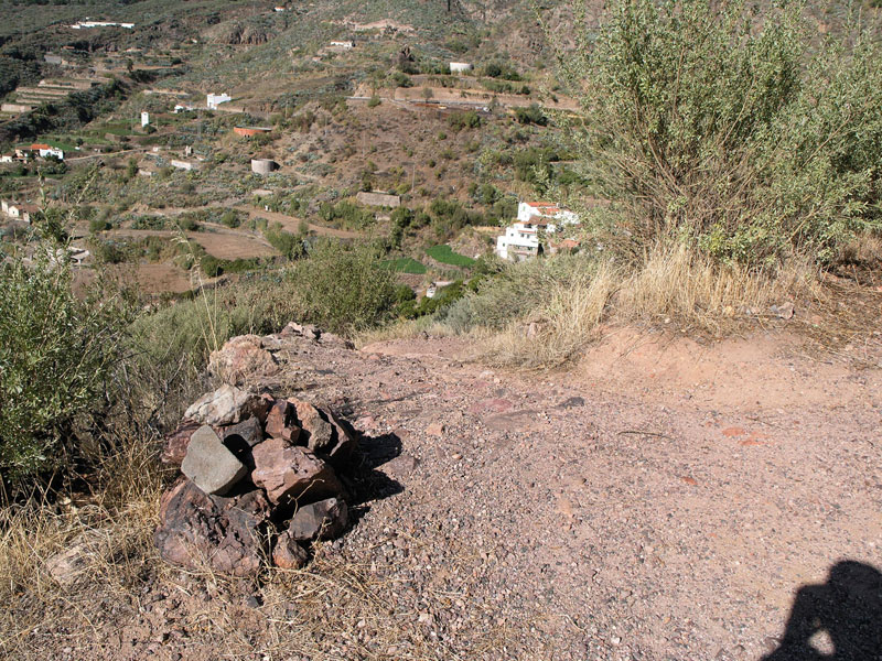
About 20 minutes later we'll come to a fence on the right-hand side of the path. We walk on, across a stream bed where we'll find some Canary Islands willows (Salix canariensis); it is the Los Molinillos ravine, where we will also find a water trough and a spring known as El Ancón. A few metres further on we'll cross over another small ravine and then walk along a flat stretch of trail, always towards the west, until the path turns south and starts to descend. Eventually we'll get to a concrete path that starts by a pretty rural house (La Palmita).
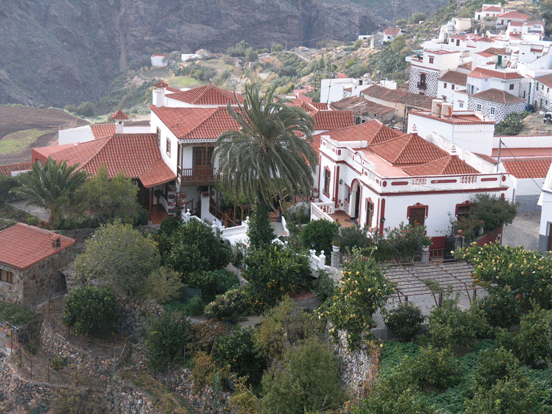
Soon we'll get to another track, this time tarmacked, where we turn right. Before we come to the last few houses with gable roofs we'll leave this track and take a cobbled path to our left that runs across farming terraces. We'll come to another concrete path which we take and then turn right and walk under a grape vine pergola, where we once again turn left onto another concrete path that runs downhill flanked by walls and houses. We will come to a tarmacked road that will take us through the centre of La Culata, where, if we so wish, we can stop and have something to eat. There are two bars, and the local specialities are goat meat, pork, wrinkled potatoes and cheese.
Stage 2: La Culata - Tejeda
 We carry on northwards along this road for about a kilometre, until -by a very narrow curve to the right- we come across a signposted path that runs downhill towards Tejeda.
We walk down this initially cobbled path, ignoring a first turning to the right, as far as a concrete track which we take for about another 30 metres before we take another path to the right that continues the descent.
Once we get to a flat stretch a new signpost leads us to a track that lies to our left. Once we reach a a pipe made of rubblework we turn left again -another sign lets us know that we should continue walking down- and walk past an old mulberry tree. A few metres further on we cross over a ravine and take a path that runs almost parallel to the stream bed. We then take a dirt track which we find by a dry-stone wall.
We must keep to the right, until we come across another great stone wall on the left-hand side that encloses a farm -a few metres away from here we'll see the connection with the track that bypassing La Culata links Cruz de Timagada with Tejeda. We walk on towards Tejeda, crossing again over the bed of the ravine, as far as the tarmacked road (Km 3 GC-60). From here, and in this case walking on the right-hand side of the road, the village of Tejeda is only about a kilometre away.
The trade winds and the overspilling sea of clouds
The Canary Islands are subject to the almost constant effect of the trade winds. They originate in the Azores anticyclone and from a north-northeast to an east-northeast direction they arrive in the islands charged with a humidity they have collected throughout their itinerary over the ocean.
Their encounter with the islands' relief causes the condensation of millions of tiny drops carried by these winds; at the same time, the obstacle posed by the islands forces this humidity to climb up the islands' relief to continue moving; at a height of about 1,500 metres (the height actually depends on the time of the year) it hits a dry layer of warm air, (a thermal inversion) that acts as a lid and stops the vertical formation of clouds and, consequently, the generation of any rain. These two factors, relief and thermal inversion, together with a more turbulent lower trade wind layer, give rise to what is known as a “sea of clouds”, typical of the northeastern side of the highest islands. This sea of clouds causes what is known as “horizontal rain”, a foggy condensation that constantly humidifies the ground surface, favouring the growth of a dense and peculiar vegetation.
When the sea of clouds finds a pass over the relief that hinders its advance, the front line of this cloud mass spills over the leeward side of the islands, rolls down mountain and cliff sides and then evaporates as it meets higher temperatures at lower altitudes -this is called the Föhn effect- giving rise to the cascade of clouds that marks the dividing line that separates the windward and leeward sides on every island.
Thyme (Genus Micromeria)
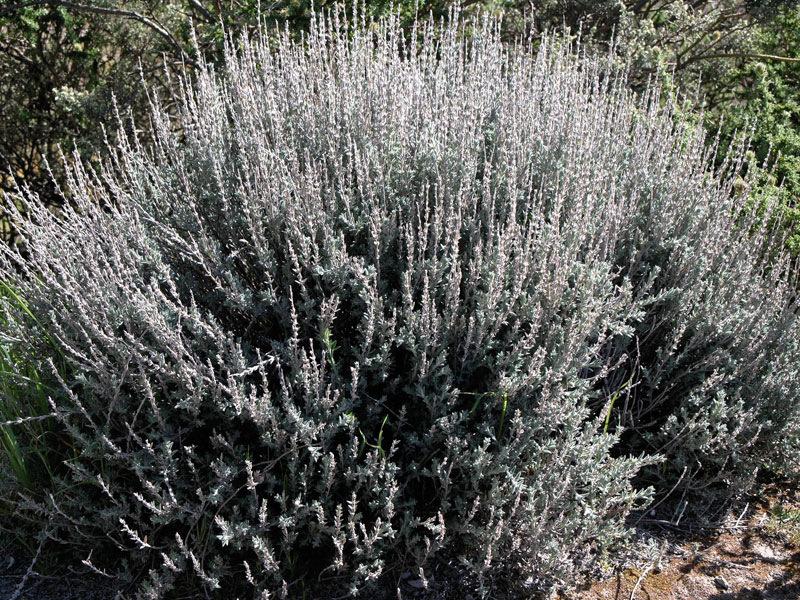
There are several endemisms among the thymes that grow both in the Canary Islands in general and in Gran Canaria in particular. This small plant is abundantly found all over Gran Canaria, different species colonizing different environments. In this central area of the island, often in association with pine forests, we may observe the fairly widespread Micromeria benthamii, especially in exposed rocky spots, and the Micromeria varia. The Micromeria lanata, though less common, is also present.
Etimologically, their generic name derives from “micros”, meaning “small”, and “meros”, which means “parts”, and it makes reference to the small size of the parts of these plants.
This small aromatic shrub has small leaves and flowers, the latter of a pink or purple hue, which have great antiseptic properties, especially against bacterian infections. A brew made with fresh leaves can be used as a mouthwash and as a desinfectant for sore throats, ulcers in the mouth and halitosis. Additionally, a cataplasm made with its leaves has traditionally been used in this area to treat bee and wasp stings.