


Llanos de la Pez - Cruz del Saucillo
GENERAL DESCRIPTION. This trail runs through the high mountain region of Gran Canaria, passing through the highest point on the island, Pico de las Nieves (1,949 metres). The trail affords walkers stunning views of the round island (Gran Canaria) and of the pointed island (Tenerife), especially of Mount Teide (3,717 metres) and of the cirque of Las Cañadas.
Throughout the walk we'll enjoy typical high mountain vegetation such as brooms and flatpods as well as reforested woods of mostly Canarian -and, to a lesser extent, aleppo and maritime- pine trees. These species thrive here thanks to the area's submontane climatic conditions, characterized by cold winters and nights and warm summers and days, in other words, by a marked thermal oscillation, both seasonal and daily. Rainfalls are lower than in the case of the Middle Mountain region, between 400 and 500mm a year, because the High Mountain region is located above the sea of clouds generated by the trade winds.
The geological make up of the area consists mainly of Roque Nublo cycle material, the intermediate series within the different volcanic phases undergone by the island of Gran Canaria. Its most outstanding feature is the Caldera of Tejeda, formed by a double process of explosion and subsidence, and subsequently modelled by erosion, the eroded material being discharged down the La Aldea ravine. It is a particularly beautiful space.
The outcrops that have survived the process of erosion, such as Roque Nublo and Roque Bentayga, are especially impressive.
Regarding human use of the territory, apart from subsistence and mountain farming, there is also a long tradition of livestock farming, shepherding and seasonal migration, the paths that crisscross the high mountain area being used to travel from the north to the south of the island in search of grazing meadows. Compared to the past, this activity, given the sharp drop in the number of livestock, is no longer as significant as it used to be.
Forest exploitation played an important role in the area's economy in the past, supporting a number of activities such as charcoal burning, the distillation of pitch for caulking wooden boats, and the sawing of wooden planks used in the building of ceilings, balconies, etc, as well as furniture-making (carpentry and cabinet-making), which involved predominantly the use of the harder heartwood of very old pine tree specimens. Another traditional activity associated with the forest was the gathering of pine needles to be used as bedding for livestock or in the packaging of bananas.
Currently, however, pine forest areas have an essentially recreational use, as is the case with Llanos de la Pez, the starting point of our walk, although in the high mountain region in general there is a growing range of tourist-related activities and services.

Trail Map
(Click on the map to enlarge it)
Trail Profile
(Click on the map to enlarge it)
 Trail description
Stage 1: Llanos de la Pez - Pozo de Las Nieves
To get to the starting point of our trail we need to take the main road that leads to the high mountain region of Gran Canaria as far as the crossroads by Llanos de La Pez, where we take the turning to Pico de las Nieves.
Stage 2: Pozo de Las Nieves - Pico de la Gorra
 About 500 metres before we reach Pico de Las Nieves -we recommend this stretch for it offers stunning views- at a crossroads where we'll find some military facilities, we turn left towards the south east. About one and a half kilometres away we'll find Pico de la Gorra, easily identifiable by the countless aerials we'll see there. There is a parking area here, and a track that is the starting point of the trail and which runs in a south southeast direction (150º ).
Stage 3: Pico de la Gorra - Calderilla Chica
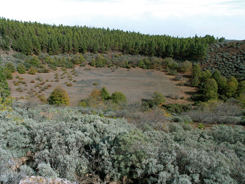 After a few metres we'll find a very eroded dyke to our right; as we carry on downhill we'll come across a landmark to the left of the path, at which point we should leave it and walk across the little ravine that we will see ahead of us. We must be careful not to slip on the pine needles that cover the ground. At this stage we are walking amidst false brooms, brooms and pine trees, all of them species of great interest for beekeepers. Once we have crossed the small ravine we take the path that runs NNW (340º), i.e. towards the crater known as Calderilla Chica. The path surface material all along is lava gravel. If we look in a SE (140º) direction we´ll see the infrastructure formerly used to load lapilli onto lorries.
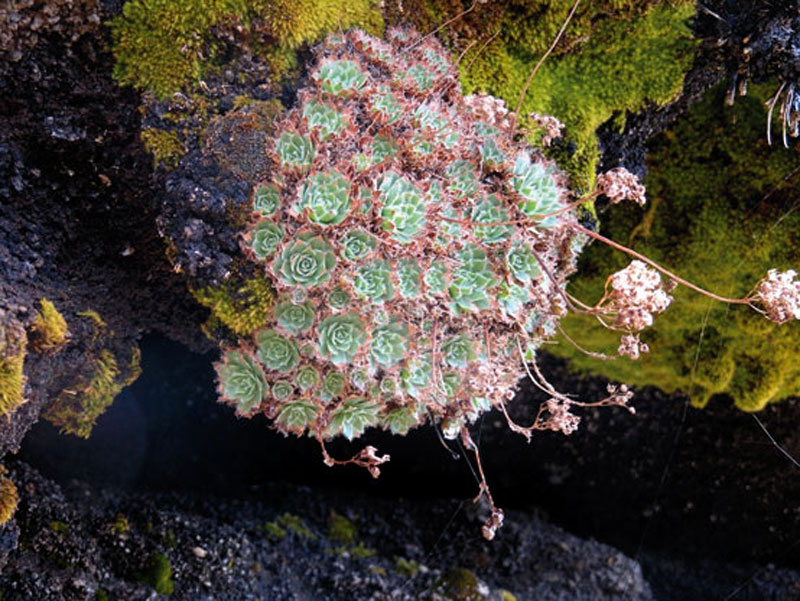
We must always follow the landmarks along the path, for they will lead us to the edge of Calderilla Chica. When we get to the bottom of the little erosion ravine, we'll find an abundant presence of brooms and even Canary Island St. John's worts (Hypericum canariense). Ahead of us we'll see a pretty stretch of slope, where aeoniums (Aeonium simsii) also grow. We walk up this slope towards the crater.
It takes about 15 minutes to get from Pico de La Gorra to this point. After we reach the edge of the caldera we walk down in a SE (130º) direction, in other words, we walk along the right-hand side edge of Calderilla Chica.
Stage 4: Calderilla Chica - Cruz del Saucillo
 The path runs uphill, softly at first, more steeply later. It will eventually take us to a track, after we have reached the first hillock. In the distance, ahead of us, we'll see a group of rural buildings. When we get to the track we'll see a signpost that identifies it, PR GC-3; to Caldera de Los Marteles; in the opposite direction it gets to Santa Lucía.
We carry on from the signpost in a N (355º) direction, and follow the path until we get to the main road that runs down to Caldera de Los Marteles first and then Telde. When we come to the main road we'll see a turning into a dirt track that has a chain across it -this will lead us to the houses we saw earlier on and, after that, to Caldera de Los Marteles. There is the option of following part of the trail that runs between Caldera de Los Marteles and Tenteniguada. (Trail 19)
We have to walk across the road to carry on downhill in a NE direction, always along the edge of the pine forest. By a curve, identifiable by the remains of a house, we'll find a turning that takes us to Pico de la Cruz del Navegante. We go up this path (in a northern direction) as far as the top of this mountain -it offers stunning views- and we'll come to a livestock farm on the right-hand side of the path.
Opposite this livestock farm there is an electricity pylon; we walk towards it and take a path that takes us to a second electricity pylon; on the way we'll see a large stone with a green paint stain and we carry on walking past its left-hand side. Likewise, we walk past the left-hand side of the second electricity pylon that lies by the beginning of a slope covered in brooms, asphodels, wallflowers, sages, feverfews, fennels and false brooms.
We take a path marked by landmarks that softly twists and turns towards the top of the hillock; we shouldn't leave the path for the rest of the slope is thickly covered in brooms and would make any ascent very difficult. This stretch ends in an open field covered in gamonas. From here on the ascent is steeper. We walk amidst brooms, and as we go up the views grow more and more spectacular, especially towards the east of the island, where we can see the municipalities of Telde, Ingenio and part of Agüimes, as well as the cliffs of Tenteniguada; towards the northeast we can see Barranco de Siete Fuentes and Lomo de Los Ingleses, in San Mateo; to the southwest, Pico de La Gorra, easily identifiable by the radio and TV aerials that stand out and finally, towards the northeast, we can see the municipality of Las Palmas de Gran Canaria and Villa de Santa Brígida, which is better seen from the top of the mountain.
At the top of the mountain we'll find the cross known as Cruz del Navegante, made of rubble masonry, which has replaced the former wooden one.
We go down by the same path, which takes us again to the main road, then to Calderilla Chica, Pico de la Gorra and, along the road that runs next to it, to Pozos de las Nieves and to the crossroads where we'll find the turning that takes us to Pico de las Nieves, the highest peak on the island (1,949 metres).
Hunting

In the Canaries in general there is a great interest in hunting. There is a Canarian Hunting Federation with delegations in every island, which are run by every island's cabildo (local government). There are also 76 associations or hunting clubs with over 19,600 members.
The hunting species available on the islands limit the activity to small game hunting, especially rabbit and barbary partridge hunting, although in Gran Canaria (the only island where it has been introduced) the red partridge is also included. In La Palma and Tenerife two big game species were introduced, the barbary sheep and the mouflon, respectively, which have actually become a problem given the threat they pose to the native flora.
Other hunting species are quails and pigeons. The most widespread hunting modality in the Canaries is with the use of Canarian warren hounds and ferrets. It has been practised since time immemorial and has hardly changed over the years. The island's peculiar irregular relief, full of nooks and crannies, makes it necessary to chase rabbits out of the cavities where they easily hide. The ferret does this, once the hound has located a den, which it signals by barking and wagging its tail frantically.
The Canarian warren hound is a dog of ancient Egyptian origin, brought to the Canary Islands by Phoenician, Greek or Carthaginian sailors. It is one of the oldest breeds known, about 7,000 years old.
Hunting activity is regulated, as mentioned above, by every island's cabildo, but the Government of the Canary Islands is responsible for certain hunting-related matters, such as legislation concerning the protection, conservation, promotion and ordered use of hunting resources available on the islands.
Cruz del Saucillo or Cruz del Navegante
The predominant volcanic material in this area is between 4.5 million to 10,000 years old, in other words, the latest material was formed during the Holocene. Two outcrops at the top of this area, Pico and Roque Saucillo, stand strikingly out for their monumentality and extraordinary beauty. Their origin lies in the acid flows that during the Roque Nublo volcanic cycle perforated the lava material. After a long process of differential erosion the most resistant material was left standing. These giant monoliths that withstood the work of erosive forces are known as roques in the Canary Islands.
Cruz del Saucillo has an elliptical base (300 x 200 metres) and a height of about 70 metres. Its southern slope has been altered by the development of colluvia.
At its summit there is a great cross that, according to tradition, was raised by Galician sailors after surviving a storm at sea -which explains its name: Cruz del Navegante (sailor's cross). However, the cross we see today is a replacement of the original -which had deteriorated badly- raised by inhabitants of the neighbouring Hoya del Gamonal, and dates from the end of the 19th century. Every year, on 2nd May, the cross is decorated with garlands .