


Cuevas Blancas - El Rincón
GENERAL DESCRIPTION. The vegetation of this natural space plays an essential role along this trail. In spring, when the different species blossom -many of them endemic to this area-, there is a delightful outburst of colour. The yellow of brooms (Teline mycrophilla), the blue of borages (Echium callithyrsum), the orange of Flower Bells (Canarina canariensis), the white of alisons (Lobularia canariensis) or the mauve colour of lavender (Lavandula minutolii) among others, make up a striking mantle that covers the Barranco de La Pasadera ravine, which owes its name (Pasadera means passage) to the fact that it serves as a pass between two large freestanding rocks in Tenteniguada: Roque Grande and Roque del Pino.
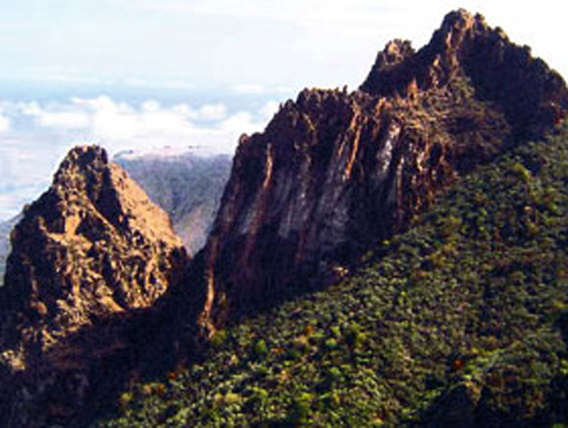
The geological diversity of the space the trail traverses is an added source of interest. The phonolitic lava flows that characterize the High Mountain Region give way to the older basaltic flows that make up the head and slopes of the ravine. Large phonolitic necks stand like towers guarding their beautiful surroundings. As we approach the little village of El Rincón, all this Roque Nublo cycle material is replaced by taluses and colluvia. Large landslides probably took place in this area, as suggested by the stunning ramps that run down to Tenteniguada from the steep walls of the caldera.
Coming down the head of the ravine, we'll enjoy splendid views of the valley and of the island's coast. We'll walk so close to the large rocky outcrops that it will feel as if we could stretch out our hand and touch them.
The Los Monzones threshing floor is also known as the de El Pino (Pine Tree) threshing floor, on account of an isolated specimen of Canary Island pine tree that stands at one of its ends. This spot, where once wheat and barley were threshed with the help of cows, now offers a shady corner where to have a rest and from which to enjoy the views of the surrounding countryside.
The trail runs through a space of high ethnographic interest. Farming terraces have taken over the slopes of the basin. They have been built mainly with rocks that over time and as a consequence of erosive processes have fallen off large outcrops. We'll see many of these stone walls on the slopes, where many rodents, such as shrews, hedgehogs or rabbits, like to make their dens.
Rocks have also been used to build the sheds that we can see cropping up amidst the vegetation. These sheds were used to store implements and tools, and sometimes, as in the case of some peculiar structures that we'll find among some chestnut trees, to house the cows and mules that, among other things, would help with the threshing of cereals.
 The diversity of the fruit trees that we will walk by along this trail turns it into a veritable stroll through the garden of Eden. The fruit grows lovely and fresh under the protection of the large rocks above. Cherries, apples, pears, plums, prickly pears, figs and so on, all have one thing in common, they all delight the palate. The last crops to be harvested are the nuts, almonds, walnuts and chestnuts, which the villagers keep for the autumn or winter festivities. From the beginning of spring until well into the summer, it is common to see farmers harvesting their crops(1).
This small basin lies in the shade of the caldera and the large rocks that crown its rim, and as a result, the space this trail traverses has a microclimate that is generally more humid and colder than that of the surrounding area. Over 200 litres of water per square metre were recorded on a particularly rainy day. According to many peasants in this area: "If much water flows down the Barranco de La Pasadera ravine, that means rain has been abundant".
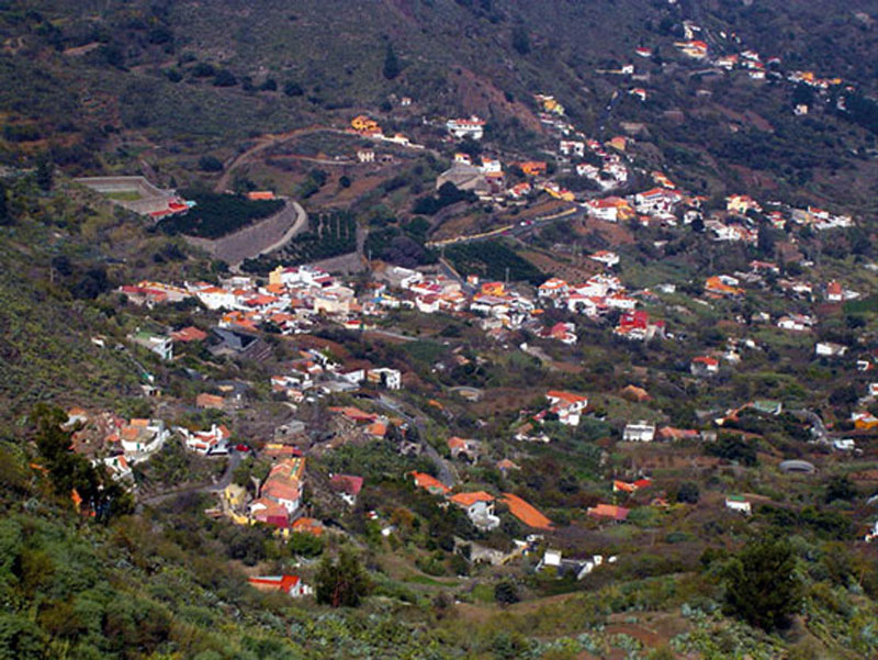
The picturesque hamlet of El Rincón is known for the kind and spontaneous nature of its inhabitants and for the exquisite high-quality cheese they produce.
(1) According to Don Periquito Navarro, an 82-year-old farmer from El Rincón, the valley of Tenteniguada used to be very rich in fruit; indeed, he himself had once hired over 8 young ladies from the village to gather in the fruit in large woven wicker and reed baskets for 5 pesetas a day. Curiously, one of these young ladies ended up becoming his wife, Doña.Esperanza Alejandro Ortega. These large baskets were carried on beasts of burden down to Tenteniguada, where they were loaded onto the lorry of Don Eusebito Pérez, who owned a shop, to be taken to the Mercado de Vegueta market in Las Palmas de Gran Canaria. At some point during the mid 1960s he bought the first van in El Rincón, in order to transport his fruit and vegetables to Las Palmas.

Trail Map
(Click on the map to enlarge it)
Trail Profile
(Click on the map to enlarge it)
 Trail description
Stage 1: Presa de Las Cuevas Blancas - Head of the Barranco de La Pasadera ravine
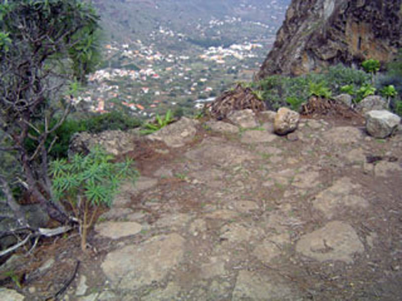
 Past the northern mountain pass of the Caldera de Los Marteles, right in front of the Cuevas Blancas water reservoir, we take a dirt track that runs down towards the head of the Barranco de La Pasadera ravine. Amidst Canary Island brooms (Teline microphylla), the path leads us past a first crossroads, where we carry on ahead towards the northeast, onto a second one (partially hidden by the abundant vegetation) where we turn left. This track runs steeply down the slope towards the northeast. Although we have not been walking for long, the trail will have already seduced us with the lovely views it affords of the northeastern sector of the island and of Roque Saucillo to the northwest, a striking freestanding outcrop. As we approach the other two most peculiar large outcrops in Valsequillo, the del Pino and the Roque Grande rocks, we come to a natural shelf on the slope which is clear of vegetation and where the substratum is of a characteristic whitish colour. We head towards the south (29º), towards the head of the Barranco de La Pasadera ravine.
Stage 2: Head of the Barranco de La Pasadera ravine - El Rincón

From the head of the Barranco de La Pasadera ravine we go down a very steep slope, twisting and turning amidst thick shrubland made up of flores de mayo (Pericallis webbii), isolated specimens of Canary Bell Flowers (Canarina canariensis) and magnificent Canary Island borages (Echium callithyrsum) (check additional information in the guide book), that often reach considerable heights.
There is a wide variety of bird species in this area. We come to the base of Roque Grande (literally, The Large Rock), where we'll find an old shed. Next to a solitary pine tree there is a threshing floor (check additional information in the guide book), which is a good spot where to stop and enjoy the views of the northeastern sector of Gran Canaria and of the hamlet of El Rincón.
There is a wealth of peculiarly shaped rocky outcrops along this stretch of trail. We are now walking along the bed of the ravine (after having done it along its shady side so far), as the presence of giant canes (Arundo donax) and ferns, moisture loving species, indicates. Once again we walk past abandoned farming terraces, vestiges of traditional agriculture. A little later we walk past a stand of chestnut trees (Castanea sativa), where the path starts to widen. We soon come to the first houses of El Rincón, some of them traditional in style, some newly built, but most of them surrounded by small farm fields. A tarmacked road brings us to the end of our trail in the centre of this charming hamlet.
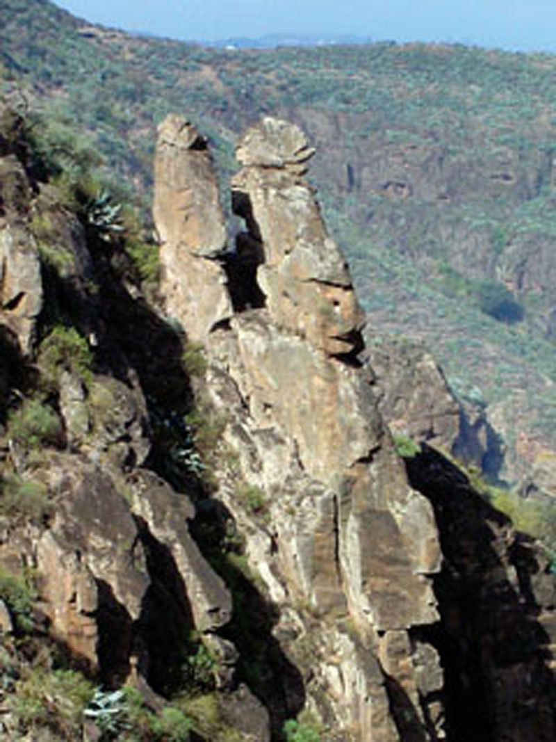
Roque Grande
A complex of large, spectacular freestanding phonolitic outcrops stand on the rim of the Caldera de Tenteniguada. The Roque Grande (The Large Rock) stands out among them on account of its abrupt steep shape and sharp summit. The formation of Roque Grande dates from the second phase of the second cycle of the geological formation of Gran Canaria, known as the Roque Nublo cycle, and it is contemporary with the formation of Roque Saucillo and of Montaña del Helechal in Valsequillo. They are the result of material ejected by volcanoes in Tenteniguada, Ayacata and La Culata de Tejeda, among others. Volcanic activity in this case was characterized by its extreme violence and by the alternation of eruptive mechanisms that developed a diversity of pyroclastic flows.
Although its name suggests this is a single rock, it is actually two volcanic plugs that make up this singular formation. What happens is that since it is oriented towards the east of Gran Canaria, which is the versant to which the Caldera de Tenteniguada is open, it gives the impression of being a single monolith with two pinnacles, hence its name. This grand volcanic plug has always been special for the inhabitants of Valsequillo, Tenteniguada and El Rincón. In fact, with time, and over many generations, it has become a symbol of identity for the inhabitants of the municipality of Valsequillo.
Grand Canary Borage (Echium callithyrsum)
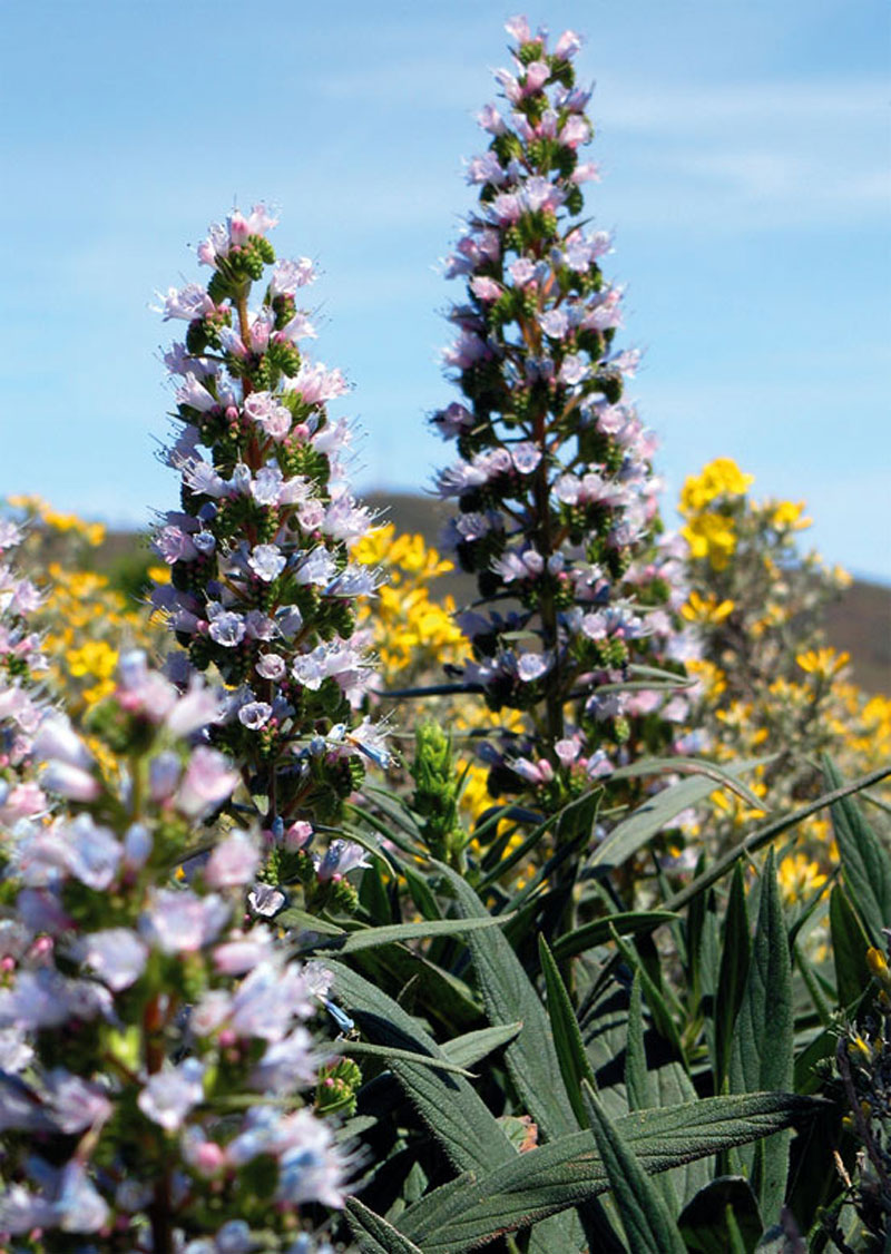
This shrub can reach a height of up to three metres. It has lanceolate-ovate leaves and a peculiar semispherical crown that combines intense blue, white and fuchsia colours during its blooming period in spring, which is the ideal season to take this route, for it allows us to admire this plant at its best.
It is endemic to Gran Canaria, and it grows, apart from in the high mountain sectors of El Rincón, in regions exposed to the influence of the trade winds, to the north and northeast of the island, and in deep-set ravines or volcanic cones. In all these cases it developes as a replacement species for the monteverde (moist forest made up of laurel forest species and myrica-erica shrub forest), together with brooms (Teline microphylla) and false brooms (Chamaecytisus proliferus), as well as with other species. Some of the latter are invasive species that pose a threat to the borage's survival.