


El Rincón - Los Barrancos
GENERAL DESCRIPTION. This is a circular trail along the Barranco de Coruña ravine. The trail runs along the bed and the sides of the ravine, reaching the foot of Roque del Pino. The elevation gain is 650 metros. Diversity is the outstanding characteristic of this itinerary. We'll come across many plant species, many of them endemic, a variety of landforms and a wide range of geological materials. This area is known as Los Barrancos (the ravines), for the large number of streams found here.
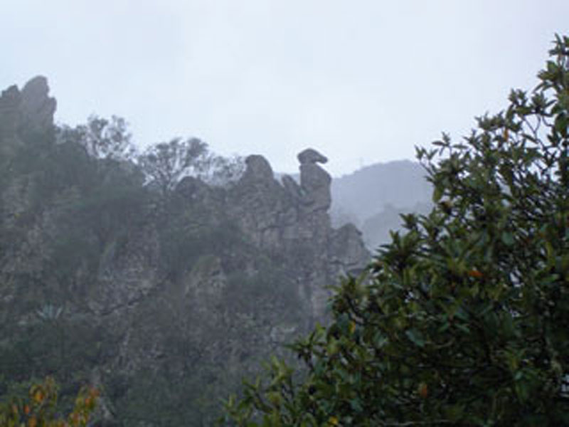
We walk over taluses and colluvia as we progress along the ravine bed and the settlement of El Rincón. On the sides of the ravine, made up of lava flows dating from the Second Eruptive Cycle, we can see small rocky outcrops (Roque Nublo volcanic breccia) that are easily identifiable by their granularity, which is typical of volcanic agglomerates. The large freestanding rocks that crown the perimeter of the Caldera de Tenteniguada reveal the strength of this material, capable of resisting the ceaseless work of erosive agents.
Over time these rocks have acquired rather whimsical shapes, and looking at them it is easy to imagine the presence of mythological animals, aztec masks, and large heads or faces. Their names often reflect this, as is the case with Roque de la Vela o del Águila (Sail or Eagle Rock), for example.
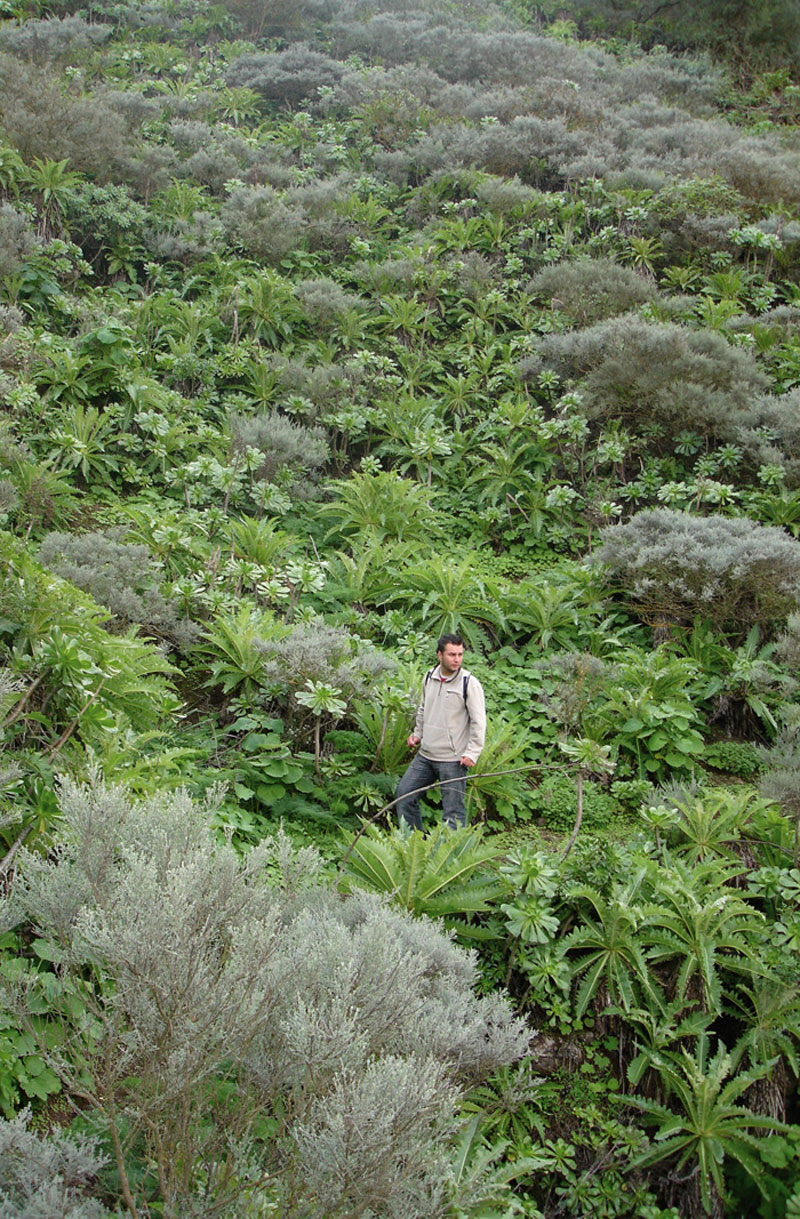
This is a place of stunning beauty, with an exuberant almost magical vegetation linked to the moisture generated by the trade winds, as several laurel forest bioindicators show, like the Grand Canary borage (Echium callithyrsum) or the Canary Bell Flower (Canarina canariensis). The area is also a birdwatcher's delight: blue tits, canaries, goldfinches, Berthelot's pipits, sparrows, blackcaps, blackbirds and Canary island chiffchaffs are only some of the many bird species that can be spotted along the trail.
During the rainy season there are many waterfalls that come down the high cliffs, offering an invigorating spectacle.
The Caldera de Tenteniguada is a natural space with a wealth of water springs, and consequently there are numerous wells and galleries along the ravine from which water of excellent quality is obtained. The trail runs past the Pozo de Los Barrancos well, located high up the ravine basin.
 There are many water tanks and cisterns scattered along the farming terraces. The water tank at Roque del Pino, at a height of approximately 1,500 metres above sea level, dug into the rock, is perhaps the most curious infrastructure we?ll find along the trail.
Our itinerary starts and finishes in the picturesque village of El Rincón, where the white colour of the houses combines pleasantly with the green foliage of trees and the brown hues of the farm fields.
During the first fortnight in July the village celebrates the Cherry Festival, this being virtually the only area on the island where this fruit is grown.

Trail Map
(Click on the map to enlarge it)
Trail Profile
(Click on the map to enlarge it)
 Trail description
Stage 1: El Rincón - Pozo de Los Barrancos
 The trail includes a stroll round the pleasant and quiet village of El Rincón. We start from the bus stop in El Rincón. We walk up El Toril street, a small slope that takes us to a crossroads where we should turn right into a concrete track which is initially rather steep. There is a beautiful centenary chestnut tree on the right-hand side of the path, as well as several Canarian traditional style sheds and dwellings.
We carry on along the left-hand side bank of the bed of the Barranco de Coruña ravine, amidst terraces where cherries and plums are grown and, after about 350 metres, we cross over the bed and continue for another 300 metres along this concrete track, that will eventually take us down to the ravine bed again. The vegetation here is luscious and exuberant; it includes Canary Bell Flowers, Canary Island alisons (Lobularia canariensis) and flores de mayo (Pericallis webbi), as well as Canary Island false brooms (Chamaecytisus proliferus). It is an ideal spot where to gaze at the landscape opening up before our eyes. From where the track ends we can see, right ahead of us, the peculiarly shaped Roque de la Vela o del Águila (Sail or Eagle Rock), as well as a slope covered in sow thistles (Sonchus acaulis), aeoniums (Aeonium manriqueorum) and Canary Island brooms (Teline microphyla), all of them yellow blooming plants.
We walk across the bed of the ravine again, towards the southwest (220º). We take the old, somewhat steep path that leads up to the Pozo de Los Barrancos well. An enormous chestnut tree can be seen to the left of the path, marking the beginning of the second stage of our trail. Before leaving the bed of the ravine, however, we should walk towards the south for about 40 metres and take another path that will bring us to a complex of ethnographic interest formed by a well and several sheds. We'd recommend stopping here for a brief rest, and refreshing ourselves with the water we'll find there.
Stage 2: Pozo de Los Barrancos - Roque del Águila
 We return to the chestnut tree and carry on towards the northeast along a narrow path that on occasions the surrounding vegetation invades. The first few metres into the path are difficult to traverse, as the surface is covered in fallen leaves and thick broom and false broom shrubs hinder our progress.
The path advances towards the east, towards the Roque de la Vela o del Águila rock. We walk over a small ravine and about 250 metres further on we get to a rocky outcrop where we 'll find perhaps the best views we'll come across along this walk (an unbroken panorama of the route so far, all the way up to Roque del Águila). We carry on and walk up to another of the better known rocks in Tenteniguada: Roque del Pino.
The path runs through well developed vegetation, and as it clears it allows us to enjoy wonderful views of the northeastern sector of the island.
At the next crossroads we turn right. The dirt path is narrow and runs parallel to a water pipe, which we leave behind at the next junction, where we carry on towards the northwest along a path covered in brooms and borages. We walk up some step-like rocky outcrops and find again the water pipe we had encountered before. We turn left and walk up a narrow track that is flanked on its right-hand side by a wall supporting an abandoned farming terrace. 150 metres later we turn to the northwest to climb a steeper slope (20º) that will bring us to a stone water tank dug into the rock right at the foot of the Roque del Pino rock.
We come down the same way we followed to get to the water tank. 700 metres further down we find a curve to the right, and we continue our descent until the next crossroads, where we take the path to the left to get once again to Roque del Águila.
Stage 3: Roque del Águila - Las Cuevas - El Rincón
 From Roque del Pino we walk down towards the Caserío de Las Cuevas hamlet. We leave Roque de la Vela behind and walk towards the east; about 6 metres away from a small water distribution basin we'll take a path to the right. The surface is somewhat hard, made up of basaltic rock, and it is delightfully flanked by ferns, century plants and prickly pear cacti. The landscape gradually reveals a greater degree of human intervention, with an increasing presence of farming terraces and houses of great ethnographic value. We come across a large number of cave-dwellings and cave-sheds, which explains this hamlet's name (Las Cuevas - The Caves). It is easy to follow the path at this stage. We next take a little path to the left that we find in front of a cave-house, which will soon take us to a tarmacked track.
Walking down this track poses no difficulties, and after about 600 metres we come to the end of our trail. This last stretch runs past several establishments selling cheese and handicrafts. There is no better way to end a walk than enjoying some of the excellent cheese made locally, or sitting in one of the village's bars and having some of their typical dishes, especially kid or pork.
Peculiar natural forms
External erosive forces such as wind, rain and watercourses, which in the past were perennial, combine over time to remove geological material from a given place, transport it and accumulate it elsewhere; in other words, the landscape is in a state of permanent modification.
The diverse geological make up of the area contributes as well to a process of differential erosion: some geological material is harder than others, and the latter yield more easily to the forces of erosion, with the result that the harder rocks that have withstood the erosive process more successfully are left standing.
The Roque de la Vela o del Águila, the Roque Jincado, or the del Pino rock among many others, are examples of these striking forms that the process of erosion has modelled in this area and which, together with an exuberant vegetation, imbue this natural space with a primeval air of mystery and wonder.
The wells
Ever since the time of the Spanish conquest, the need for water has driven Canary Islanders to dig wells to withdraw water from underground aquifers. However, it was with the expansion of banana and tomato productions that well digging took off. The process of digging a well was hard and complicated because of the dimensions of the wells -about 3 metres in diameter and up to 200 metres deep- and because they were dug into hard volcanic material. It also required raising a relatively large building to house the machinery associated with water extraction. The process of extraction involved the use powerful pumps -initially powered by gas oil, later electric pumps were used.
Inevitably, overexploitation led to an alarming alteration of the water table in the Canary Islands in general, and in Gran Canaria in particular. At present, alternatives have been sought, like desalination and wastewater treatment plants, which has turned Gran Canaria into a pioneer in the application of certain new technologies.