


Caldera de Los Marteles - Las Vegas
GENERAL DESCRIPTION. This is one of the few trails that rather than run along hill ridges or interfluves actually follows the bed of a ravine over long stretches. The ravine in question is also one of the most beautiful natural spaces on the island, the Barranco de Los Cernícalos ravine. R22 Caldera de los Marteles - Las Vegas
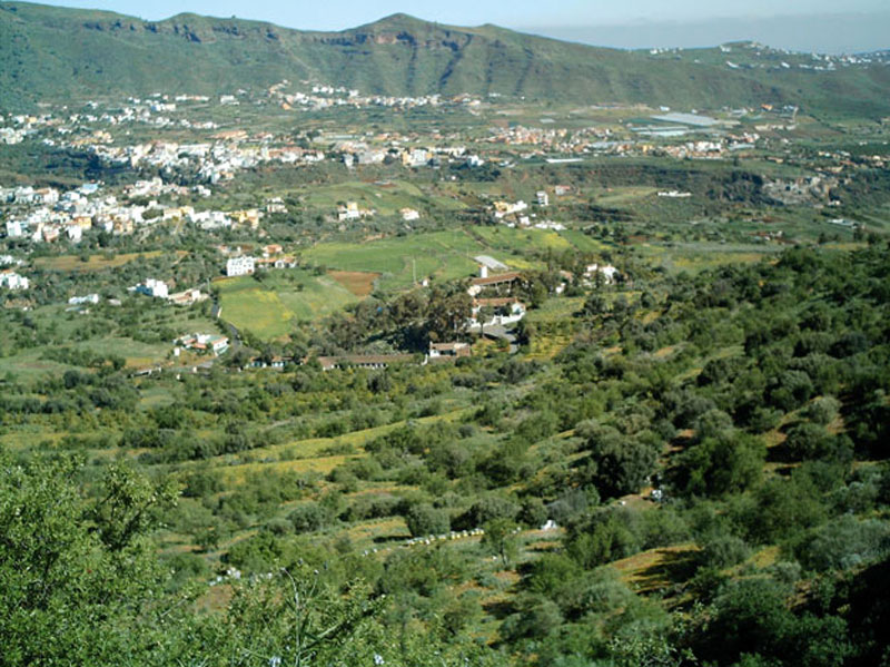
It is about 10 km away from Telde, and from its head -which starts at the northern end of the Caldera de Los Marteles-, the ravine runs on Roque Nublo basaltic and agglomerate material, past formidable cones belonging to the most recent volcanic cycle.
However, what is really unique about this itinerary is the biological diversity that characterizes this space, and the fact that it is the only permanent watercourse in the whole of the east of Gran Canaria, and possibly in the whole of the island as well. This has an obvious effect on the surrounding vegetation, and, for example, the wild olive tree (Olea europaea ssp. cerassiformis) prospers on its banks, forming one of the largest and best preserved colonies on the island.
Particularly significant is the willow forest (Salix canariensis) that covers the bed of the ravine, for it forms the largest riparian forest on the island. The green thickness of the vegetation contrasts in winter with the white flowers of the almond trees (Prunus dulcis) that grow on the slopes. Other species that grow in this environment are brooms (Teline microphylla and Retama monoesperma), false brooms (Chamaecitisus proliferus) and spurges (Euphorbia obtusifolia), as well other endemisms like the Canary bell flower (Canarina canariensis), the Grand Canary borage (Echium callithyrsum) and the pink maple-leafed Canary shrub mallow (Lavatera acerifolia).
There is a surprising number of nesting bird species, the most common being corn buntings, linnets, canaries, grey wagtails, turtle doves, red robins, Western Canary kestrels and long eared owls, among others. The combination of bird song and the murmur of water is a delight for walkers.
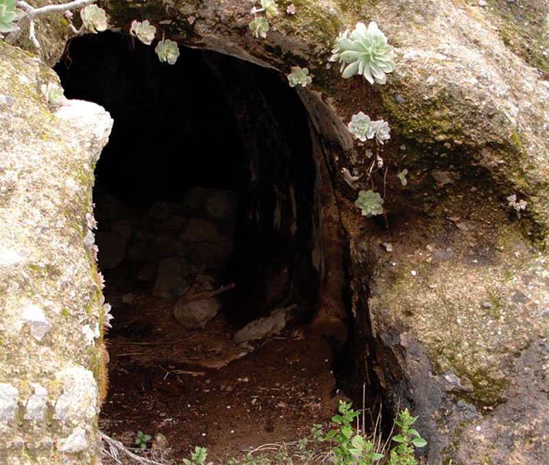
 Land use in this area used to be mostly farming, mainly fruit and vegetables, but at present most farming terraces have been abandoned. The numerous cave-dwellings and cave-sheds on the slopes reveal that farming has been an age-old practice in the ravine. Likewise, the number of farm houses found along the middle and final stretch of our itinerary also indicate the importance that agriculture once had in this area.
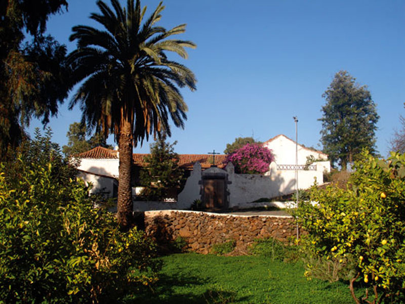
Among other examples of traditional style architecture, the Hacienda de Los Mocanes country estate is worth highlighting.

Trail Map
(Click on the map to enlarge it)
Trail Profile
(Click on the map to enlarge it)
 Trail description
Stage 1: Caldera de Los Marteles - Montaña de Cuevas Blancas - Barranco de Los Cernícalos ravine bed
 We start our trail by the northern wall of the Caldera de Los Marteles. We take a dirt track towards the east that runs through a pine forest and through an undergrowth made up of brooms. After about 250 metres we take a track to the right, in a S-SE direction (160º), which runs down the head of the Barranco de Los Cernícalos ravines. To the right of the track we'll see a complex of cave-dwellings and large specimens of false brooms, almond trees and Canary Island brooms.
A few metres before we reach the end of the track we catch sight of the path we should now take on the slope opposite. To get to it we have to a turning to the right, towards the east, for about 20 metres. Once we have crossed over the bed of the ravine we take a path up the northern slope, leaving two young chestnut trees behind. The path carries on flanked by abandoned farming terraces that have been colonized by spurges, sages, fennels, cardoons and feverfews.
After about 400 metres we come to a crossroads down in the ravine itself. We'll ignore the turning to the left that runs up the slope and we carry on along the right-hand side bank of the watercourse, in the direction of the hamlet of Cazadores -though we won't be going that far.
On the slope opposite we'll see a large number of prickly pear cacti, century plants and almond trees.
Through a small ravine bed we arrive at another dirt track in the proximity of Montaña de Cuevas Blancas, which we'll find right next to a false broom; we follow this track towards the east. About 450 metres later we come to a tarmacked road; we walk across it and continue our descent down the basin of Los Cernícalos ravine along another track that brings us, past a small stand of about six or seven Canary Island pine trees, to the bed of the ravine.
As we go down, the small farm houses we see lying among fields give way to large specimens of false brooms, wild olive and almond trees. Near the watercourse we'll see a threshing floor, a reminder of the intense agricultural past of this area. The murmur of water and the shady willow trees that we'll find once we get to the bank of the stream will tempt us to stop for a rest. We recommend yielding to this temptation.
Stage 2: Barranco de Los Cernícalos ravine bed - Las Cañadas
 We have to walk about 80 metres back on the same path we came down, to take another small path that we'll find by an old walnut tree. This path runs along the right-hand side bank of the watercourse, towards the east.
Environmental humidity is quite high along this stretch of the trail, where we'll be walking across the watercourse several times, alternating between the left and right-hand side bank of the stream. About 300 metres down the path we cross over the stream and carry on down the left bank. We climb up a small slope from which there is a lovely view of the thick riparian willow forest. We'll also come across features of ethnographic interest, like a small spring, a threshing floor and a complex of at least three cave-sheds where animal forage can still be seen.
Past the last cave we'll come to a small shelf from which there is a nice panoramic view of the head and middle stretch of the Barranco de Los Cernícalos ravine, which seems to be teeming with life thanks to its exuberant vegetation.
We leave this natural viewpoint and turn south, walking down towards the watercourse again. The slope is very steep and its surface slippery, so we should step carefully. When we get to the bed of the ravine we'll be surprised by the fact that it appears to be dry, although we can hear water running. This is because of the permeability of the material that makes up the bed of the ravine, and over certain stretches it flows underground. We cross over the bed again and continue walking along the slope exposed to the north; we'll notice how the environmental humidity increases, especially as we get closer to the once again visible water. The path now seems to have entered a delightful enchanted forest, with ferns, lichens and moss growing lusciously under the shade of huge, over ten-metre-tall willow trees.
After alternating between the left and right-hand side banks a few more times the path eventually leaves the watercourse and climbs up a slope in the direction of the casa del humo (literally, the smoke house). A few metres away, past a group of over two-metre-tall spurges, we come to a crossroads, where we take the turning to the left. We'll walk down a steep slope that will bring us to a lava gravel track in the area known as Las Cañadas. The track runs over a red ochre deposit, formed by the rubefying effect of the enormous, more recent lava flow that lies above our heads on the older soil below it.
Stage 3: Las Cañadas -Los Mocanes -Las Vegas
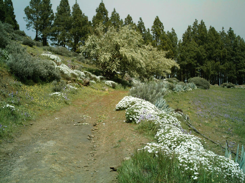
 By the edge of a lava gravel cone we take a track that runs down a gentle slope towards the northeast. In spring, the white weeping brooms and the almond trees combine to fill this natural space with delightful splashes of colour. As we approach Los Mocanes the trail starts to offer panoramic views of Las Palmas de Gran Canaria, los Llanos de Valsequillo and the Caldera de Tenteniguada.
On the way down to Los Mocanes we'll catch sight of Las Haciendas, an enormous agricultural estate where wonderful examples of traditional Canarian architecture are to be found. We turn right once we come to a tarmacked track, past a palm tree that grows in the middle of the track. We carry on towards the north, towards the village of Las Vegas, where our trail comes to an end.
The Canary Island willow (Salix canariensis)
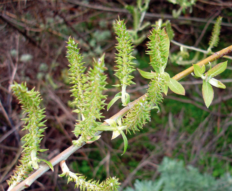
Several colonies of Canary Island willows grow along the watercourse of the Barranco de Los Cernícalos ravine, and they probably make up the most impressive willow forest on the island. The optimum conditions of humidity provided by the water that runs all year round has favoured not only the development of this riparian willow forest, but also the fact that individual specimens often grow beyond the average height of willows elsewhere -about 8 metres- and often reach heights of between 10 and 12 metres, thus looking more like trees than like the robust shrub they actually are. It would have been more natural to find this species prospering in the Middle Mountain Region, under the influence of the trade winds and the moisture generated by the horizontal precipitation caused by the sea of clouds, and indeed this was the case until the 19th century, when the development of the port in Las Palmas and the consequent demand for fuel from visiting steamships led to the widespread cutting and near extinction of this species in this region.
Beekeeping in the Canary Islands
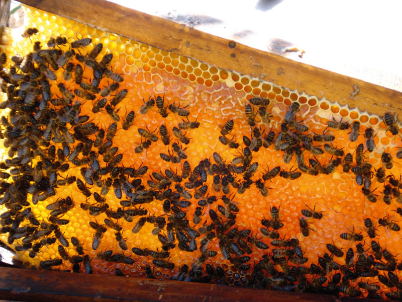
Every year some 200 tons of honey are produced in the Canary Islands, which is not a very large quantity, but the quality is outstanding. This honey comes from native plants, and its later processing is entirely done by hand, with no chemical additives whatsoever. About 600 people, both amateurs and professional, work in the beekeeping sector in the islands. There are about twenty thousand beehives, where Canarian black bees -a species that 200,000 years ago developed from a different African bee species. It is practically the only bee species in the Canary Islands, and it has excellent characteristics from the point of view of beekeeping, such as a high degree of productivity, tameness and trouble-free adaptation to the environment.
Gran Canaria, with 60% of the beehives in the Canary Islands, produces 6,000 tons a year and is the second largest producer after Tenerife. The Middle Mountain Region, given the diversity of its flora, produces honey of the highest quality.