


Cuevas Blancas - Tenteniguada
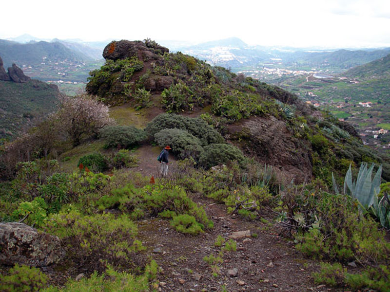
GENERAL DESCRIPTION. If there is a word to describe this itinerary, that word is "diversity". Starting off from the island's High Mountain Region, we arrive at one of the most beautiful corners in the east of the island: the Caldera de Tenteniguada.
From the northern end of the caldera we go down the head of one of the ravines with the richest flora in this area. The large basaltic rock walls give rise to a landscape where escarpments rise among steep slopes that run all the way down to boxed in gullies. The views this trail offers are stunning -of the whole of the east and north sides of Gran Canaria, of the High Mountain region, even of Mt Teide in Tenerife, if the day is clear enough and we go up the optional stretch that runs up the back of Roque Saucillo.
The trail starts at a spot of unique beauty, near a dense pine forest off the Presa de Cuevas Blancas water reservoir, one of the oldest on the island. We'll find a range of water storage and transport infrastructures along the way, like water tanks, deposits and irrigation ditches.
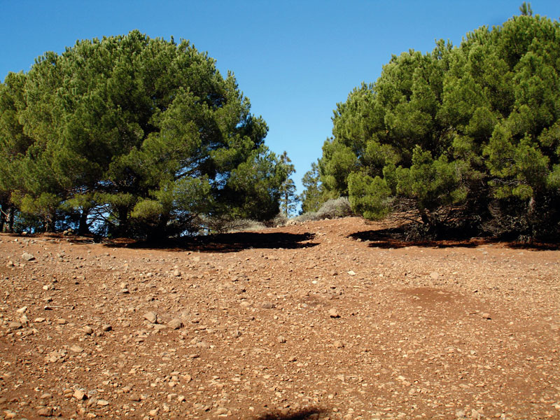
This region is the southern border of the area of influence of the sea of clouds. The pine forest is an excellent harvester of the horizontal rainwater generated by the trade winds, retaining moisture in its pine needles and cones. Humidity is thus high and fog is frequent.
The predominant species in the pine forest is the Canary Island pine tree (Pinus canariensis); the species that make up the forest undergrowth vary depending on exposure, but they are generally Canary Island brooms, flatpods and asphodels, among others. Lichens grow abundantly on trees and fungi on the ground. In the middle and final stretches of the trail there is a rich floristic diversity, the most significant species being the Canary Island willows (Salix canariensis), wild olive trees (Olea europeae ssp. Cerassiformis), the Canary Bell Flower (Canarina canariensis), the popularly knows as tomateros silvestres or wild tomato plants (Solanum lidii), which are endemic to this area, the Canary golden mountain rose (Greenovia aurea) and Grand Canary borages (Echium callithyrsum), among others. If we are lucky we'll come across the legendary Flor de mayo leñosa (Senecio hadrosomus), the same species the botanist Eric Sventenius, founder of the Viera y Clavijo Botanic Garden of Las Palmas de Gran Canaria, ceaselessly looked for around these cliffs during the 1960s.
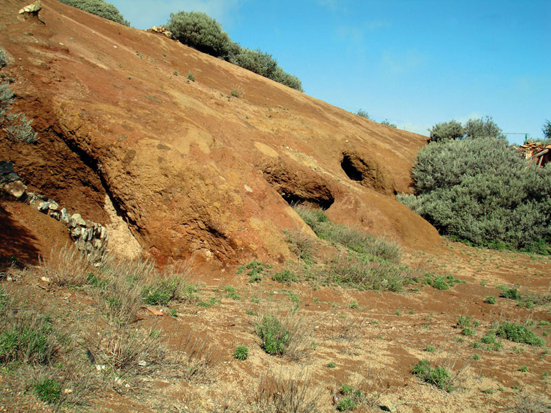
There is also an enormous diversity from a geological point of view. We'll come across phonolitic lavas, Roque Nublo volcanic breccias, basaltic flows, sedimentary deposits and colluvia, as well as freestanding outcrops such as Roque Saucillo or Roque Jincado, made up of hauynite phonolites.
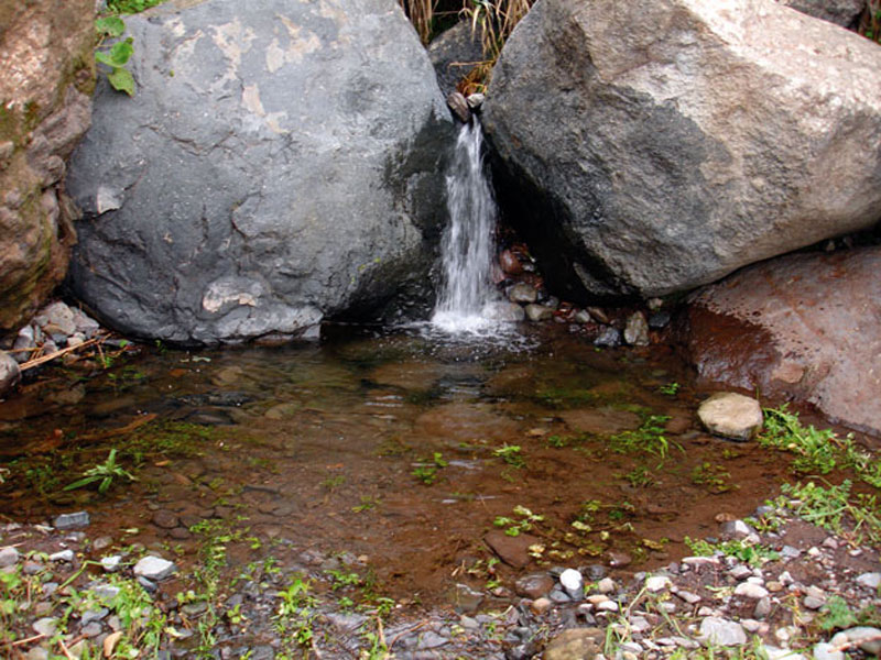
At the Roque Jincado, or "Peñón Rajado" (cracked rock), as the locals call it on account of its peculiar shape, we'll see an abandoned water gallery, of ethnographic interest. The gallery is next to a water tank dug into the rock, which is at present completely closed up by a landslide caused by a storm that dismantled part of the rocky outcrop. Many villagers worked on this gallery, and in its surroundings we can still see the remains of their work, rails, fuel barrels and so on. The gallery's history takes up a special place in the collective memory of El Rincón, for as the oldest villagers still remember, a dynamite explosion killed one of the workers and wounded many others.
Water is a fundamental feature along this route, and it has modelled the terrain like a sculptor. In autumn and winter it runs down the endless succesion of ravines and gullies our trail runs past and across.
The village of El Rincón is attractive for many reasons: for the hospitality of its inhabitants, their loving attitude towards the environment and agriculture, their artisan heritage, their traditional style architecture and the liveliness of its folk music and traditions.

Trail Map
(Click on the map the enlarge it)
Trail Profile
(Click on the map to enlarge it)
 Trail description
Stage 1: Presa Cuevas Blancas - area near Cruz del Saucillo
 The trail starts right opposite the Cuevas Blancas reservoir, where a track sets off which is also the starting point for the Pasadera itinerary (Trail number 27). The path runs parallel to the road, bordering a pine forest.
We gradually move away from the pine forest and into shrubland made up mostly of large brooms (Teline microphyla). When we get to a clearing -just before a building that we can see towards the northwest- we turn to the right and walk up for a few metres, carrying on past a group of cave-sheds we find at the foot of the building we had previously seen. We now take a wide track as far as the next crossroads, where we turn to the right, towards another reforestation pine forest.
Optional stretch of trail
 About 600 metres away from the crossroads we come to a wider flat stretch colonized by pine trees (Pinus radiata)(1), where we leave the track and take a path to the left that runs up towards the northwest amidst pine trees and brooms.
Although the slope is steep and the path not ideal, it is worth the effort, for once we arrive at a rocky outcrop by the edge of the mountain pass -from which we can see Roque Saucillo's southern face- we'll enjoy spectacular panoramic views of the northwest coast of Gran Canaria and even of the majestic Mt Teide, on the island of Tenerife (3.718 m).
(1) This species is easy to tell apart from Canarian pine trees (Pinus canariensis), as its shape is rounder, with a wider crown and only two needles per fascicle.
Stage 2: Area near Cruz del Saucillo - Roque Jincado
 Near the pine grove where the optional stretch of trail above starts, we leave the track and turn to the right. We walk parallel to a small ravine, past a tar kiln in a perfect state of preservation. We come to the track again -there are countless shortcuts off it, usually off to the left, on the narrower curves, but we should avoid them because it would be easy to get lost. We take a path that we'll find near a shelf on the slope and walk down a steep slope towards the northeast, past a volcanic cone covered in lava gravel to the left. When the path rejoins the track we'll find another path that starts near a stand of chestnut trees (Castanea sativa), which we'll take to continue our descent towards the east, with the Grandes Roques of Tenteniguada ahead of us and Roque Saucillo behind us. When we arrive at a small group of flatpods (Adenocarpus foliolosus), we turn left, past a water tank and abandoned farm fields, a reminder of this area's agricultural past.
An abandoned farming terrace will serve us as a point of reference, as the trail becomes a bit confusing now for several paths converge at this spot. We need to take the last path on the right, in other words, the one running closest to the mountainside. After walking across a small ravine bed we carry on towards the southeast amidst Grand Canary borages (Echium callithyrsum), sages (Sideritis dasignaphala) and Canary Island brooms. The path gradually narrows as it reaches a pine forest, twisting and turning through it, until we eventually get to Roque Jincado.
Stage 3: Roque Jincado - El Rincón
 We go down to the left of this large rock, although we should stop briefly to delight ourselves with its whimsical shape and with the specimens of Canary Bell Flowers (Canarina canariensis) that grow around it. This is the most difficult stretch of our trail, so we should be careful, although it soon eases off after we have gone past a deep water tank boxed into the terrain. From here we can appreciate the impressive cliff walls, modelled by the waterfalls that appear during the rainy season. Apart from the species mentioned above, from here on we'll also start to see wild olive trees (Olea europaea ssp cerasiformis) and century plants (Agave americana).
Two hillocks stand out ahead of us. We should border the first one on the right-hand side, then walk on over the pass, past the second hillock, after which we should turn towards the southeast.
We walk downhill along a narrow path and, when we get to some sheds next to a grove of almond trees, we walk across to the left. After about five minutes we turn to the right and get to a concrete track which will bring us, amidst water tanks and farm fields, down the Barranco de La Coruña ravine to the settlement of El Rincón.
The Canary Bell Flower (Canarina canariensis)

It is a herbaceous plant that belongs to the Campanulaceae, a family which includes three species; the Canarina canariensis is endemic to the central and western islands, including Gran Canaria, and normally grows at an altitude of between 300 and 1,100 metres above sea level, in shady areas with moist, humus-rich soils.
It is a bioindicator of changes in laurel, juniper and myrica-erica shrub forests.
Its tuberous root is thick, with up to three-metre-long ramified hanging stems. The beautiful flowers are bell-shaped and red to orange in colour. It blooms between November and May. It is used as an ornamental plant in gardens and its fruit -already known by prehispanic Canarians- is edible and sweet when ripe.
Artisans
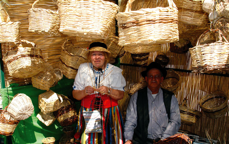
There is a large number of artisans in the Middle Mountain Region. They have learned their trade from their parents, who in turn learned it from their parents and so on across generations; in other words, their craft forms part of the cultural heritage of this region.
Some of these crafts, like basket making with reeds and canes or some palm-based weaving date from prehistoric times. Handicrafts in general met the demand for items needed in the everyday lives of rural population, like baskets, woven strands, clothes and traperas (scraps of cloth made with leftover threads and used to craft mostly bedspreads and rugs), as well tools and implements for agricultural work, such as yokes, ploughs, panniers, sickles and so on.
Wicker and reed baskets were in great demand in the past, for they were used to transport an endless range of items at home, in the fields or between villages. For instance, they were used to gather and transport fruit, vegetables or potatoes at harvest time, or to carry forage to feed animals with.
Women, among other crafts, specialize in making objects out of palm leaves.
They make use of the palmito -the the tenderest palm leaf, of a whitish colour-, rye and reeds, to make mainly mats and rugs, panniers (which were used to carry things, even piglets or kids, on donkeys), small baskets, sowing cases, hats, bracelets, bags, woven strands to wrap up cheese with, tablemats and all sorts of other items. In most of these cases the essential tools used were the artisan's own hands.