


Degollada de Becerra - Lagunetas
GENERAL DESCRIPTION. This trail runs through an area that stretches from a ravine that starts in the High Mountain region of Gran Canaria down to the higher Middle Mountain region of the municipality of Vega de San Mateo. The ravine is the Barranco de La Mina, whose name derives from the water gallery that connects its headwaters with the Caldera of Tejeda, although further down its course it is known as the Barranco de Guiniguada ravine.
The trail is exposed to the trade winds and their characteristic sea of clouds (windward NE side of the island). In the area of Las Lagunetas, the phenomenon of horizontal precipitation favours high rainfall rates, above 800 mm, with large annual -and daily- thermal oscillations that are higher than those in other areas in the lower Middle Mountain regions or on the coast of Gran Canaria. These conditions favour the potential development of lauraceae and pinaceae species . The use of mountain sides for agricultural activity has given rise to a landscape shaped by terraces where dry-farming crops are grown, mostly destined to family consumption or the domestic market. The main crops are potatoes, cereals, legumes, vegetables and fruit, as well as almonds, chestnuts and walnuts.
In the upper stretch of the ravine the climate changes, and it becomes typical of a middle mountain region of an altitude between 1,500 and 2,000 metres. Rainfall rates are lower -about 400 mm a year- and thermal oscillations, both annual and daily, are much greater. In December and January there might be occasional snowfalls, although it seldom settles for long. The vegetation is mostly made up of brooms and flatpods (Adenocarpus foliolosus y Teline microphylla), as well as false brooms (Chamaecytisus proliferus) and other small plants, like sages and thymes.
Reforestation pine trees mainly Canarian pines (Pinus Canariensis) coexist with other introduced conifers (Pinus halepensis, pinaster, radiata, etc.). Forestry has always been of importance among the rural population of the island (charcoal-burning, wood-sawing, pitch-making, the gathering of pine needles, and so on), although these activities are at present regulated and limited as these forest areas are included in protected spaces -this area, for instance, lies within the El Nublo Rural Park. Since prehispanic days shepherds have brought their flocks to graze in these areas, mainly sheep and goats whose milk is used for small-production artisan cheese-making. The pastures where animals have grazed impart their distinct flavour to these handmade cheeses.

Trail Map
(Click on the map to enlarge it)
Trail Profile
(Click on the map to enlarge it)
 Trail description
Becerra - Lagunetas
The trail's starting point is by the Interpretation Centre at Degollada Becerra, which offers detailed information on the formation of the Caldera of Tejeda.
We can reach the Interpretation Centre both via the central main road (GC-2) or via the crossroads at Llanos de la Pez. The trail starts opposite the parking area, where there is usually a stall selling souvenirs and typical products (cheese, ron miel (honey rum), bienmesabe (almond-based sweet), etc).
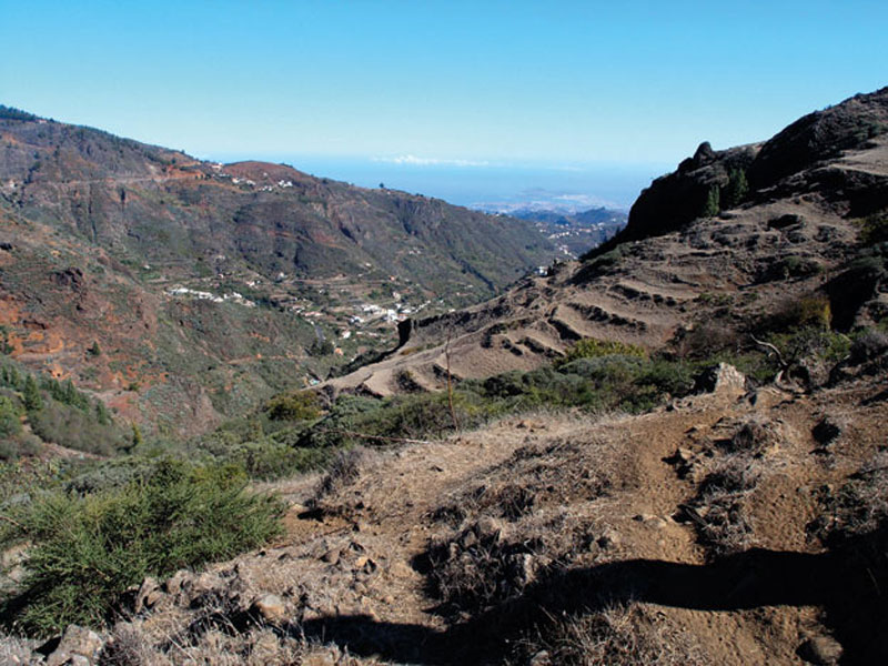
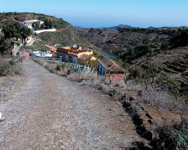
The path runs in a SE (140º) direction, leaving the Caldera of Tejeda behind. It is a dirt path, with hardly a gradient, that takes us into the headwaters of the Barranco de La Mina ravine. The path is flanked by brooms, flatpods and false brooms, as well as chestnut trees and mimbreros. At the end of the path, at the bottom of the headwaters of the Barranco de La Mina, we find the remains of a red house, with three caves in front of it that were used as sheds in former times, and opposite it, below our path, a water gallery known as Boca de la Presa.
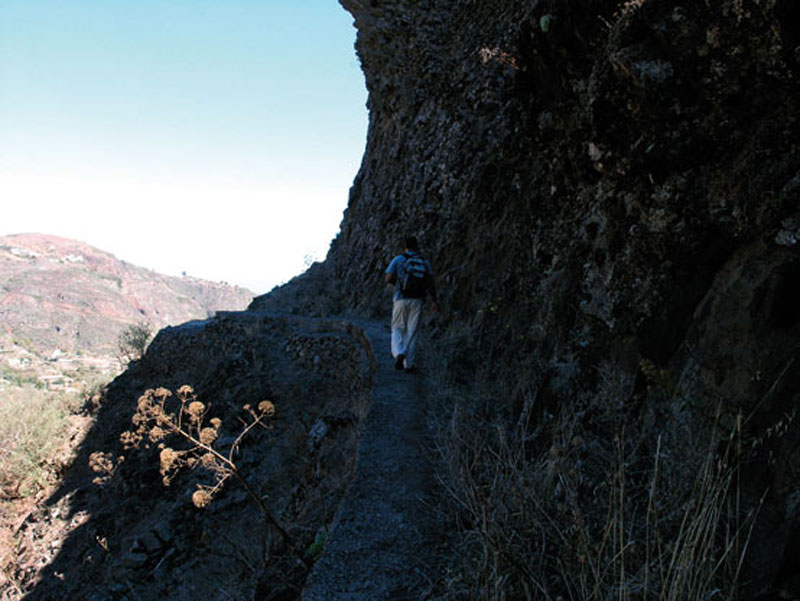
By the entrance to the gallery and in a northern (20º) direction, we take a dirt track that runs downhill along the right-hand bank of the ravine. We'll see some sort of construction as we leave the Barranco de La Mina to our left. The path narrows -in winter we should be careful not to slip- and we come to an enclosure with goats and sheep whose water troughs are three metal bath tubs; we carry on past them towards the shepherds house, passing by a large fig tree and by a dry-stone wall.
We can now see two water mills on the slope opposite, next to the entrance of the La Mina gallery; one of them is abandoned, but the other is still active. We leave the shepherd's house to our right -our path runs below it- and we carry on ahead as far as some large rocks (known as peñas) from which there is an excellent view of Las Palmas de Gran Canaria, as long as it is a clear day and there is no sea of clouds. From those rocks we can also see a large chestnut tree, towards which we go as our path runs straight under it.
Once by the chestnut tree we have the option of briefly leaving our trail to enjoy some spectacular views of the northeastern side of the island, including the city of Las Palmas de Gran Canaria. There are two alternatives: the first one is to go down a path that runs parallel to a pipe as far as some freestanding rocks; and the second involves climbing up the slope and getting to the dykes by their summits, where we'll find an old hut that probably served as a shed or refuge for shepherds.
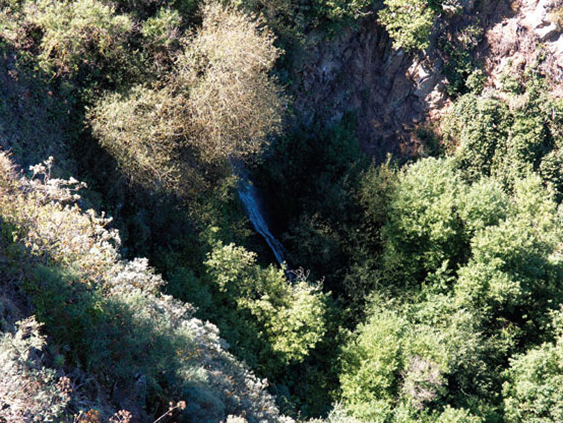
After enjoying the views, we return to the chestnut tree and descend along the bed of the ravine that we'll see in front of it. An old rubblework pipe runs down the slope as far as the path that leads to Las Lagunetas. We walk in a NE direction, with Las Lagunetas to our left, at the bottom of the ravine. Before we arrive at the village of Las Lagunetas we walk past the waterfall of Barranco de la Mina. Further on we'll come to a cave-shed and, opposite it, a galvanized steel-pipe from which water flows and is collected in a trough dug into the rock for animals to drink from. We carry on and we arrive at another shed, in this case a recently built one, made of rubblework(1). The path carries on to the left of this building, leading us to a spectacular talus pile, with a notable number of aeoniums.
On the opposite slope we'll see a cinder cone from which a path sets off and where there is a water gallery. As we carry on we'll get to an area of dykes that will afford us a truly impressive spectacle. It is a structure of agglomerated Roque Nublo material over which there is a trachybasaltic flow with columnar joints, its upper end covered by other emissions of Roque Nublo agglomerate.
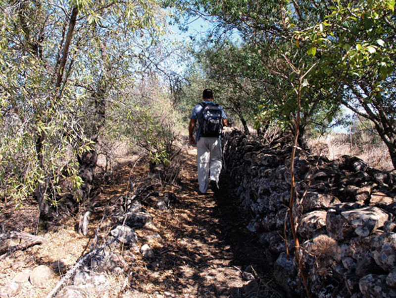
We continue along our path and come across the rubblework pipe again. We get to a dirt track with a fork, where we should ignore both turnings and take a narrow path opposite us that sets off towards the NE. We walk downhill amidst flatpods and parallel to a drystone wall on our right.
We walk past a house with a very large chestnut tree to our right and turn in the direction of Las Lagunetas along a steep path. After that we go down a concrete track that takes us to the main road (GC-21) first and then to the chuch.
The trail ends by the church in Las Lagunetas, dedicated to Saint Bartholomew and to the Immaculate Heart of Mary. The village is renowned, among other things, for its mills and bakeries. From the church we can walk across the square down towards the bed of the ravine, to La Yedra and Utiaca (Trail 5. Las Lagunetas - Utiaca).
(1) It is a new pipe that runs parallel to the path.
Traditional Bakery

Bread has become a staple in the diet of modern Canarians, much as gofio used to be in former times. The bread baked in the Middle Mountain Region is made with aniseed, and enjoys island-wide popularity. Egg bread and potato bread are also made, as well as a range of pastries made with lard, flour and almonds. At number 4, San Francisco street, in Las Lagunetas, there is an old oven. It dates from the 20th century, and it has a surface area of about 130 square metres. There are three mouths that were used both to extract baked products and to introduce logs to fire it. The flooring of the bakery is made of basalt stonework from Arucas.
Although the original construction has been altered -the old oven has been replaced by a new one- it is in a good state of preservation. The old oven is still used to produce some pastries and wood-fired bread which are usually sold on Sundays at the local market in San Mateo.The flour is still kneaded by hand, which is very hard work, but which produces bread of a texture, body and flavour very different from that produced by industrial bakeries.
The mills of Las Lagunetas


Molino de los Ortega o Molino de la Boca del Túnel (The Ortegas' Mill, a.k.a. Tunnel Entrance Mill)
This mill dates from the 19th century and it is still in use producing gofio. It is found in Barranco de La Mina, near Degollada de Los Molinos. It is well preserved, although the original structure has been modified. The latest reforms were undertaken by its current owner, don Manuel Sánchez Rodríguez, in 1971. The mill is powered by water from the La Mina water gallery, which belongs to the Heredad de Las Palmas (an Heredad is an association of water owners). In the lower part of the mill it is possible to see the counter wheel with its vanes.
Molino de Abajo, del Túnel o de La Cumbre (Lower Mill, a.k.a. Tunnel or High Mountain Mill)
It dates from the 19th century and it has a surface area of merely 16 square metres. At present it is abandoned. It is in a spot known as Era de Pata, in Degollada de Los Molinos, in the Barranco de La Mina ravine, in an area close to Las Lagunetas.
Molino de Cho Gutiérrez, Huerta del Molino o Molino de Enmedio de Las Lagunetas (Cho Gutiérrez' Mill, a.k.a. the Vegetable Garden Mill or The Mill in the middle of Las Lagunetas).
The mill dates from 1874 and it stayed active until the end of the 20th century. It has a surface area of 60 square metres. It is at present, as the photograph shows, in a state of neglect. It is in Las Lagunetas itself, in the Barranco de La Mina, about 100 metres away from number 20, La Longuera street, where the path that leads to it starts. On the outside we can still see the flume that fed the wheel, which reaches a height of 15 metres; it enabled it to develop 8 h.p., or, in other words, to grind up to 300 kg of gofio over 8 hours. There are three rooms: the roasting room, the store room and the mill's machinery room.
(SOURCE: DÍAZ RODRÍGUEZ, J.M (1989): Los molinos de agua en Gran Canaria. Excmo Cabildo de Gran Canaria. Las Palmas de Gran Canaria).