


Siete Fuentes - San Mateo
GENERAL DESCRIPTION. This trail starts within the perimeter of the Protected Landscape of las Cumbres (High Mountain Region), an area of particular floral wealth, with very peculiar endemisms.
The Canary Island Foxglove (Isoplexis isabelliana) and the Pericallis hadrosoma grow in the area of Hoya del Gamonal, which is to the south west of San Mateo and is the headwater of the Guayadeque ravine. The International Union for Conservation of Nature declared in 1984 that the Pericallis hadrosoma was one of the twelve most threatened species in the planet. It is a shrub that can reach almost two metres in height and which grows exclusively on the most inaccessible cliffs in Tenteniguada and in the dales of Gamonal and Camaretas. The special climatic characteristics of these areas, caused by the combination of their relief and the trade winds, favour rather moist cool conditions throughout the year. Thus, in Hoya del Gamonal there used to be an especially dense laurel forest thanks to these permanently humid conditions and to the important rainfall -an annual average of 782mm- received by this area.
These climatic conditions have altered the existing volcanic flows, facilitating the formation of a reddish soil that is easy to break up.
This trail runs through areas that are to a large extent publicly-owned, belonging mainly to the city councils of Vega de San Mateo and Las Palmas de Gran Canaria. The latter collects part of the water that springs in the area of Siete Fuentes. At the beginning of the 20th century an English company supplied the city of Las Palmas with water extracted from this area. The water travelled from this area down to Llano de las Brujas in iron pipes, running under the brewery that is still active.
This is also the area where neveros or “snow collectors” did their trade -perhaps the least known of the local traditional trades. Neveros was the collective name given to those who went to the “snow wells” to be found in the high mountain area to collect snow and then press it into compact shapes, to the muleteers who brought it down to the cathedral and to the man responsible for selling it at the nevería or snow shop. Many of these men came from the municipality of Vega de San Mateo, from Camaretas and Hoya del Gamonal.
Throughout a great part of the itinerary we'll be able to see, standing high above us, the cross known as Cruz del Saucillo, which is also known as Cruz del Navegante or Sailor's Cross. It is 1,800 metres above sea level, on the border between San Mateo and Valsequillo. Its name is traditionally attributed to some Galician sailors who, in gratitude for having survived a storm at sea, raised a cross on this spot in the 18th century. On 8th June 1884, amidst great celebrations, a new -the current- cross was raised to replace the original, severely deteriorated wooden one.
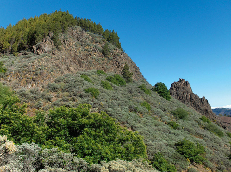
The scenery to be enjoyed at Hoya del Gamonal and Camaretas is characterized by grazing meadows, areas of reforested pine woods, shrubland and stone walls, a reflection of the economic activities -agriculture, forest exploitation- undertaken in this area during the second half of the 20th century. The intervention of man on the landscape is particularly noticeable in the settlements of La Lechuza and La Lechucilla.

Trail Map
(Click on the map to enlarge it)
Trail Profile
(Click on the map to enlarge it)
 Trail description
Stage 1: Degollada de La Capellanía - Camaretas Hostel
 The trail starts at Degollada de La Capellanía, by a clearing to be found to the left of road GC-130, which connects Los Pechos and Telde. 600 metres away from the crossroads, just off a road known as "de Los Marteles", on the left-hand side of the road in the direction of Telde, there is a flat stretch where we'll find the beginning of a dirt track. We follow this track which, amidst pine trees and in a en direction, leads us away from the road and into the pine forest.
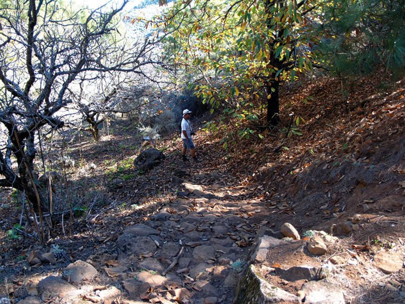
After walking through a clearing we come across a beautiful chestnut tree, and two minutes later we'll find a cobbled path to our right. If it has been raining we should be careful not to slip on it, in fact, we should be careful all the way to Hoya del Gamonal, for the whole of this stretch can be very slippery. The path widens and ends by the ruins of an old house. We walk past it and to the left we'll find another path that twists and turns downhill amidst pine trees, chestnut and apple trees and brooms. If we look up at this point we'll see Cruz del Saucillo, and to the NE there is a splendid panoramic view of the city of Las Palmas de Gran Canaria. If we listen carefully, we'll be able to hear the murmur of water flowing down the small gully to our left, along a streambed that has been taken over by brooms and ferns. There are also some old stone walls that remind us of the fact that this used to be a farming area.
 As we get to the first few houses of the hamlet of Lomito Blanco, the ground changes colour and we join a dirt track. A few metres on, by a curve to the right, the track goes down towards the left, first amidst pine trees, then amidst false brooms and later on amidst eucalyptus trees. We leave one of the headwaters of Barranco de La Higuerilla to our left and we take a forest track in a NE direction that will take us to Las Casillas. In geological terms, the material that characterizes this stretch is Roque Nublo volcanic breccia.
We carry on past a fenced water deposit and arrive at Degollada de La Bilandra, a natural scenic viewpoint from which we can see the village of San Mateo, Montaña Cabreja and the lava gravel quarry of Montaña de Troya. Only a few minutes past this spot we`ll come to the hostel at Camaretas.
Stage 2: Camaretas Hostel - San Mateo
 Once we get to the hostel at Camaretas we carry on along the dirt track. We turn right in an E-SE direction and about 50 metres further down we turn left towards the north, which will open up a wonderful view of the whole of Vega de San Mateo.
EThe path is well signposted. We leave the ravine of Camaretas to our left, and when we get to a farm enclosed by a fence we ignore the turning to the right and walk on along a flat stretch of trail. The path narrows as it starts to descend. Although it becomes less defined from this point on, it is not difficult to follow it. At this stage of the trail we have the gully of La Higuera on the right and the gully of Camaretas on the left.
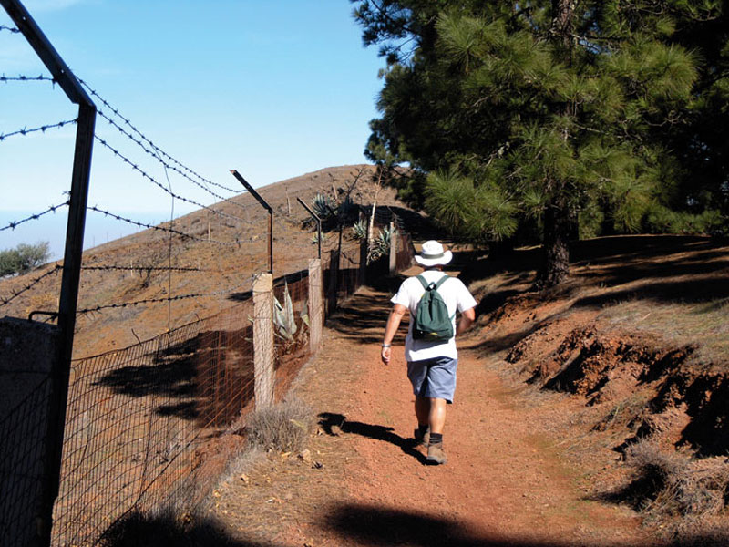
When we come to a fork we take the turning to the right, it is a more comfortable shortcut that runs under the shade of pine trees. We carry on walking downhill along Lomo de Los Ingleses until we get to the tarmacked road that leads to La Lechuza. We walk along this road for a further 600 metres, walking past a a house with a hip roof and a perimeter wall covered in volcanic rock. After another 80 metres we come to a clearly signposted path that runs along the northern edge of Montaña de Troya. Human intervention shapes the landscape we are looking at now: dwelling houses alternate with farming fields where fruit, potatoes, corn and some vegetables are grown.
 When we get to a tarmacked road we should turn right, towards the NE-E. The road is clearly sigposted and it will lead us amidst old farms, water deposits and dwelling houses to the main road that runs between San Mateo and Valsequillo. Once there we'll carry on walking downhill for a further 150 metres in an eastern direction as far as a shortcut that we will find opposite the Cuatro Caminos water distribution basin. The shortcut will take us to the road again, we'll walk across it and carry on downhill in a N-NE direction. Finally, we once again come to the road, cross it yet again and walk on along a tarmacked road that will bring us to the village of San Mateo.
The Canary Island Foxglove (Isoplexis isabelliana)
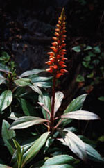
It is a shrub which is endemic to Gran Canaria exclusively, and tends to grow in areas bordering pine forests, between 600 and 1,700 metres above sea level.
It is a protected species. It can reach a height of up to one and a half metres, and its narrowly lanceolate, serrate leaves are about 15 cm long, and deep green in colour.
Its striking orange-red flowers grow in terminal clusters over 20 cm long. It blooms between April and June and fructifies between June and August, and its flowers are favoured by birds and insects.
It is a sun-loving species that thrives in moist soils, and it is usually found growing in cracks in steep rock walls.
Water springs
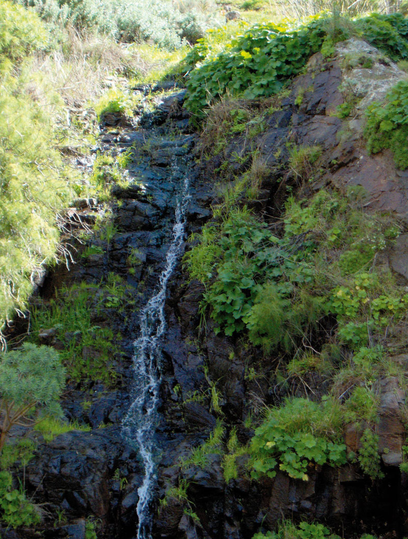
They are an important water resource for the island. Spring water is used for both human and animal consumption, although animals never ever drink directly from a spout, but from a nearby water trough, another suitable structure or simply from a puddle. Water springs are the result of groundwater emerging from below when the piezometric level is very close to the surface, and the aquifer can no longer contain further infiltration of rain water.
Given Gran Canaria's volcanic nature, springs are associated with two geomorphological elements: fossil soils and dykes. The former are brought about by incandescent lava flows coming into contact with topsoils, rubifying them and making them impermeable. Thus, water that filters through lava flows finds no permeable layers through which to continue descending and tends to surface where fossil soils and lava flows come into contact. Dykes, on the other hand, are chimneys through which magma surged. When it cooled down an impermeable structure formed within the conduit, which now retains the water that circulates inside the volcanic edifice. In this case water filters out at the point where the dyke and the adjacent rock it cuts across meet. Infiltration galleries on the islands are almost always dug breaking through dykes, for it is common knowledge that behind them there is a good chance of finding large reserves of water. At the time of the Spanish conquest there were over 500 water springs on the island, but with the widespread perforation of infiltration galleries and wells the piezometric level of groundwater fell and these sources gradually dried up. At present there are barely 20 springs left. Some of them have mineral medical properties, so in the past some of them have been by exploited by spas.